Beneath ordinary coastlines, entire cities and sanctuaries now sleep in salt and shadow. Earthquakes, tsunamis, land subsidence, and deliberate flooding have all pushed monuments underwater, turning former harbors into ghostly archives. Divers and archaeologists move through avenues meant for carts and courtyards meant for prayer, mapping lives that ended long before modern ports rose nearby. Each submerged site holds a different story of loss, engineering, and belief, yet together they reveal how deeply humanity has always trusted the sea across continents.
Heracleion, Egypt’s Sunken Gateway
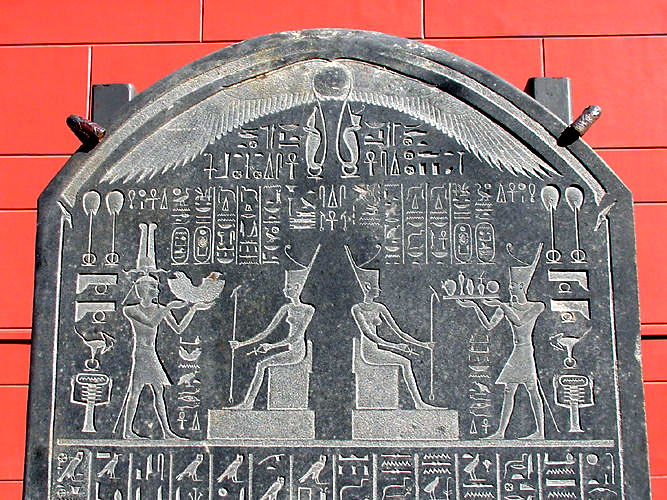
Once a thriving coastal hub, the lost city of Heracleion now rests off the Nile Delta, its avenues strewn across the seafloor like a shattered map. Earthquakes and soil liquefaction dragged this harbor under more than one thousand years ago, freezing trade in a single long disaster that nobody on shore fully understood. Colossal granite pharaohs, hieroglyphic stelae, and shrines to Amun lie among seagrass and mud, revealing a place where river festivals, foreign merchants, and temple rituals once collided, turning the harbor into a crowded stage for belief, wealth, and royal power. Today, survey grids still widen around it each year.
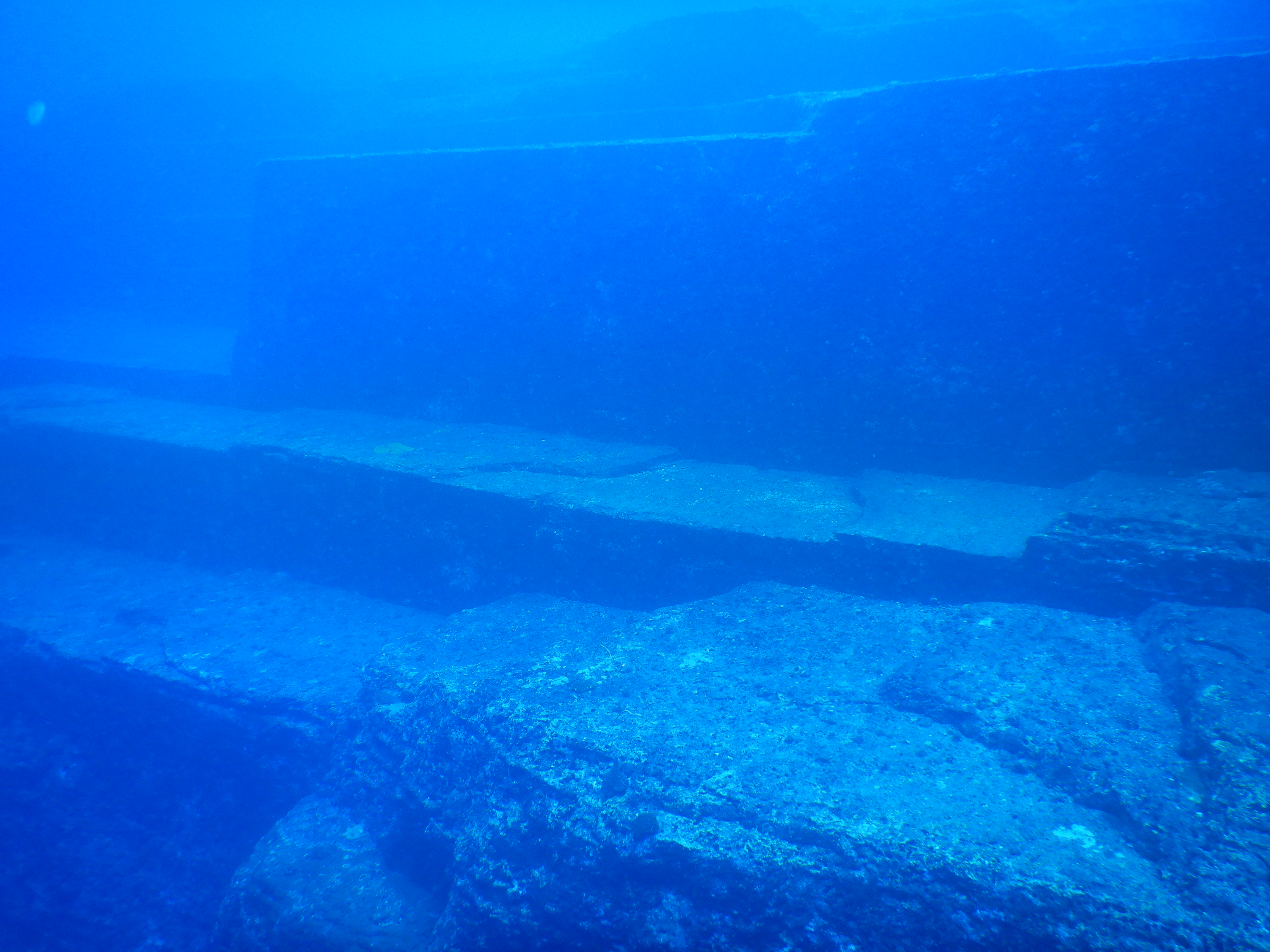
Pavlopetri, Greece’s Stone Age Waterfront
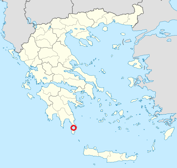
Off southern Greece, the submerged town of Pavlopetri lies traced in sand, with streets, courtyards, and rows of small chambers still clearly outlined. The settlement slipped under around five thousand years ago, likely due to earthquakes and gradual sea level rise after the last ice age reshaped the Laconian Gulf. Pottery fragments, stone basins, and narrow walkways hint at weaving, fishing, and family rituals carried out close to the tide line, while fish now dart at window height and waves above mark the old shoreline of a busy Bronze Age waterfront community. The plan is clear enough to sketch almost by eye.
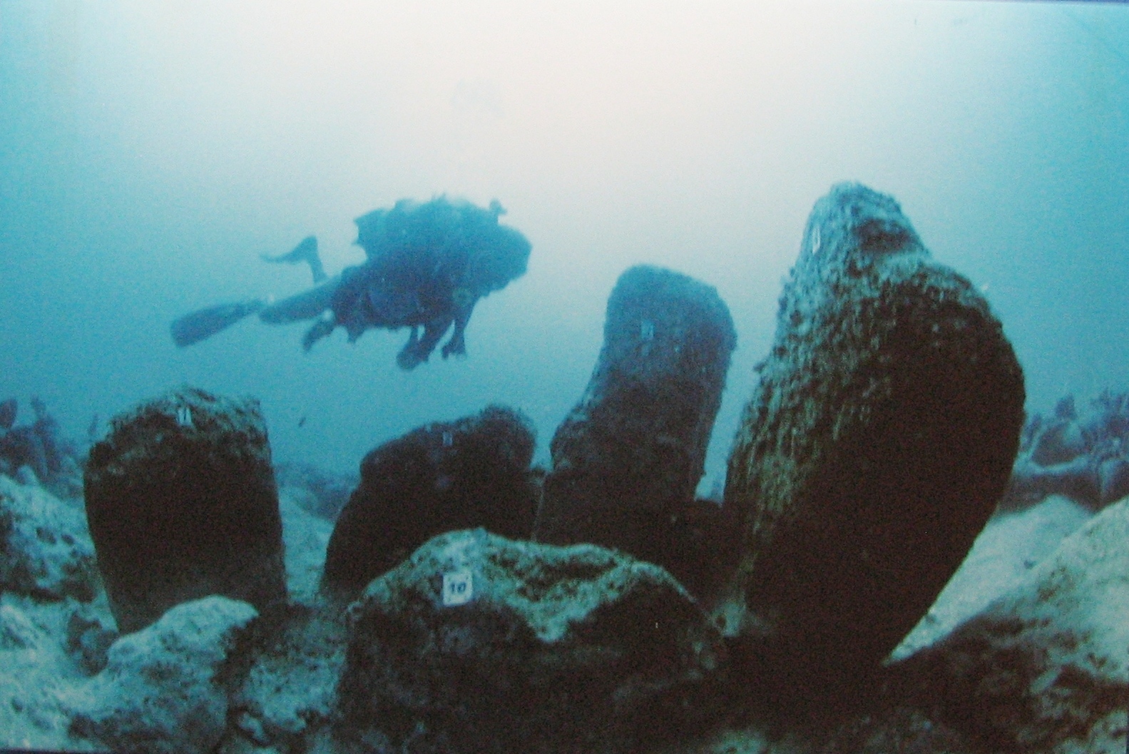
Yonaguni’s Mysterious Submerged Terraces
Near Japan’s Yonaguni Island, stepped terraces and sharp corners rise from the seabed like a half-buried monument, stirring repeated arguments about their origin. Some researchers see a natural sandstone formation carved by currents and slow fractures, while others point to flat platforms and straight edges as signs of deliberate shaping by early stone workers. Nicknamed the Yonaguni Monument, its carved-looking channels and ledges feel eerily architectural in good visibility, inviting speculation about a forgotten coastal culture that watched the Pacific horizon from this very rock before it slipped underwater.
Atlit-Yam, A Neolithic Village Under Waves
Just off Israel’s Carmel Coast, the Neolithic village of Atlit-Yam lies in a calm, greenish light, its stone houses and open courtyards still recognizable on the seabed. A ring of megaliths encircles a freshwater well, suggesting communal ritual around the same resource that sustained cooking, farming, and daily work. Human remains show early cases of tuberculosis and signs of care, while animal bones and sickle blades tell of fishing, herding, and shared meals. Rising seas after the last ice age quietly claimed the village, preserving a rare underwater record of early coastal society, captured almost mid-breath.
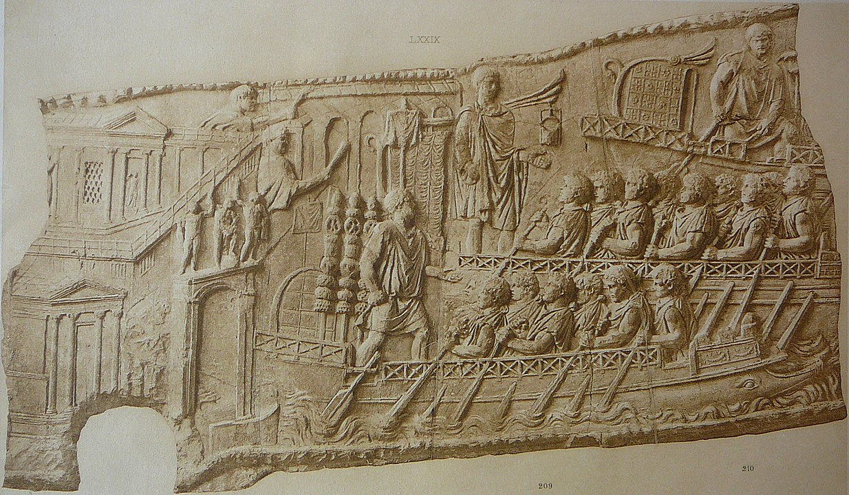
Baiae, Rome’s Drowned Pleasure Resort
Along Italy’s Bay of Naples, the drowned resort of Baiae sits beneath the waves, where mosaics, colonnades, and collapsed villas once entertained Rome’s most powerful figures. Volcanic activity slowly lowered the shoreline, submerging bath complexes, private docks, and gardens where emperors pursued pleasure, alliances, and quiet schemes in the same afternoon. Divers now follow streets lined with faint fresco traces and marble fragments, imagining whispers in steam-filled rooms, clinking cups, and careful negotiations in loggias that today shelter only seagrass, shy fish, and drifting clouds of volcanic silt and sand.
Port Royal, Jamaica’s Shattered Pirate Haven
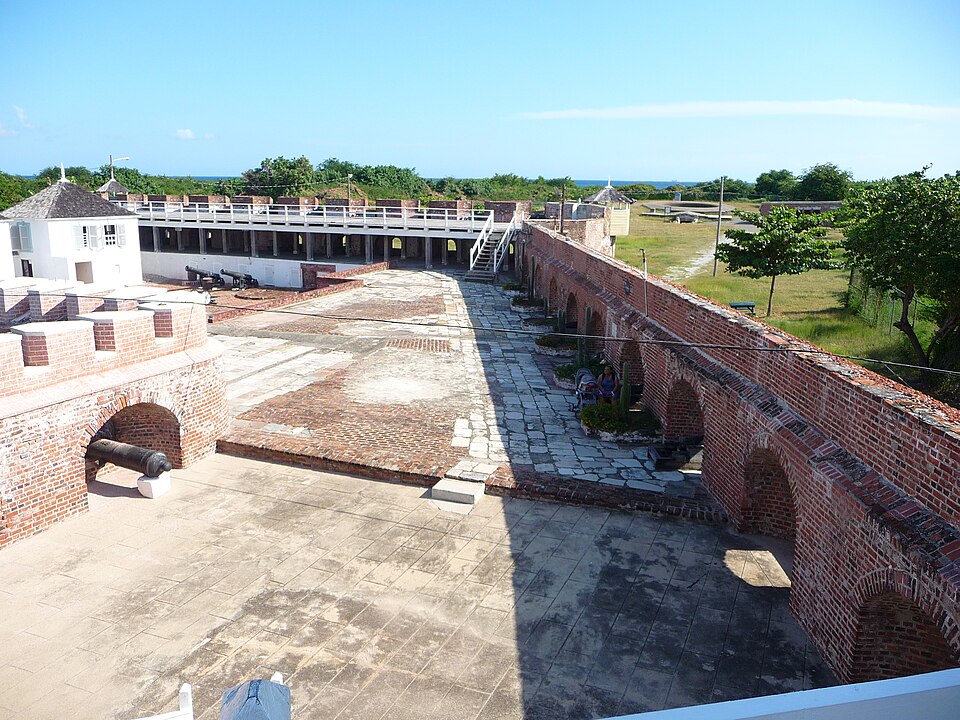
At the edge of Jamaica’s harbor, part of old Port Royal lies locked in sediment after an earthquake in 1692 shattered the sandy spit beneath it in minutes. Streets, cellars, and timbered rooms slid into the sea so fast that clay pipes, bottles, coins, and household goods remain unusually well preserved in the quiet dark. Once infamous for pirates, privateers, and rum-soaked taverns packed along narrow lanes, the sunken quarter now reads like a paused scene in a chaotic drama, as archaeologists trace how an overbuilt, unstable town paid dearly when the ground failed. Even doorway angles still hint at the quake’s motion.
Lion City of Shi Cheng, China’s Flooded Town
Deep below the surface of China’s Qiandao Lake, the Lion City of Shi Cheng stands preserved in still, cold freshwater, its city gates, towers, and rooftops surprisingly intact. The valley town was deliberately flooded in the 1950s to create a large reservoir, which sealed wooden beams, carvings, and stone lions away from air, traffic, and heavy modern construction. Arched doorways, alleyways, and decorative façades now line silent avenues lit only by dive lights, capturing a moment when merchants, students, and families left behind their homes as the rising lake swallowed farms, temples, and streets.
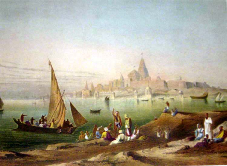
Mamallapuram’s Submerged Temples, India

Off India’s southeast coast near Mamallapuram, carved stone blocks, walls, and broad platforms lie beneath churning surf, echoing the famous shore temples that still rise on land. Local legends long described seven magnificent pagodas, and underwater surveys have revealed structural remains that hint at a larger ceremonial complex continuing into the bay. Tsunamis, storms, and coastal erosion likely erased much of it, yet sculpted fragments and careful alignments suggest a ritual landscape where priests, sailors, and patrons once watched the Bay of Bengal’s changing light from sanctuaries close to the water’s edge.
Offshore Dwarka and Harbor Legends
Offshore structures near modern Dwarka and in India’s Gulf of Khambhat have fueled debate about ancient harbors connected to layered stories of Krishna’s legendary city. Sonar images show geometric patterns, possible walls, and platforms that may represent complex coastal settlements constantly adjusting to shifting sea levels, tides, and sediment. Pottery fragments, anchors, and stone blocks recovered so far point toward active maritime trade routes, while cautious interpretations keep a clear line between myth and evidence as archaeologists slowly map what truly lies beneath the swirling brown water and seasonal currents.
Neapolis, Tunisia’s Sunken Garum Factories
Near Tunisia’s Nabeul, large parts of the Roman city of Neapolis rest underwater after a fourth century earthquake and tsunami abruptly reshaped the coastline and nearby bays. Mosaicked floors, workshops, and processing vats reveal a major center for making garum, the fermented fish sauce that flavored countless Mediterranean meals and elite banquets. Today, fallen columns, storage basins, and domestic rooms sit in clear shallows where sunlight still reaches the bottom, linking ancient industry and family life with the present-day coastal town that faces the same sea that once swallowed its streets.
Cleopatra’s Harbor Quarter in Alexandria
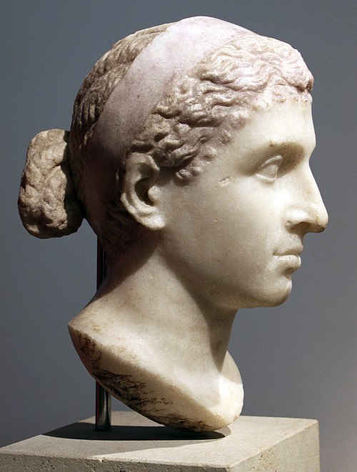
In Alexandria’s Eastern Harbor, fragments of palaces, temples, and harbor works lie scattered across the seafloor, often linked in imagination with Cleopatra’s royal quarter and ceremonial routes. Earthquakes and subsidence fractured this section of the Ptolemaic capital, pulling monumental columns, statues, and sphinxes into the Mediterranean along with busy quays. Divers now move through broken courtyards and along toppled obelisks while survey teams chart foundations and stone alignments, gradually recovering the layout of a waterfront district where Hellenistic power, ritual, and everyday port life once collided.
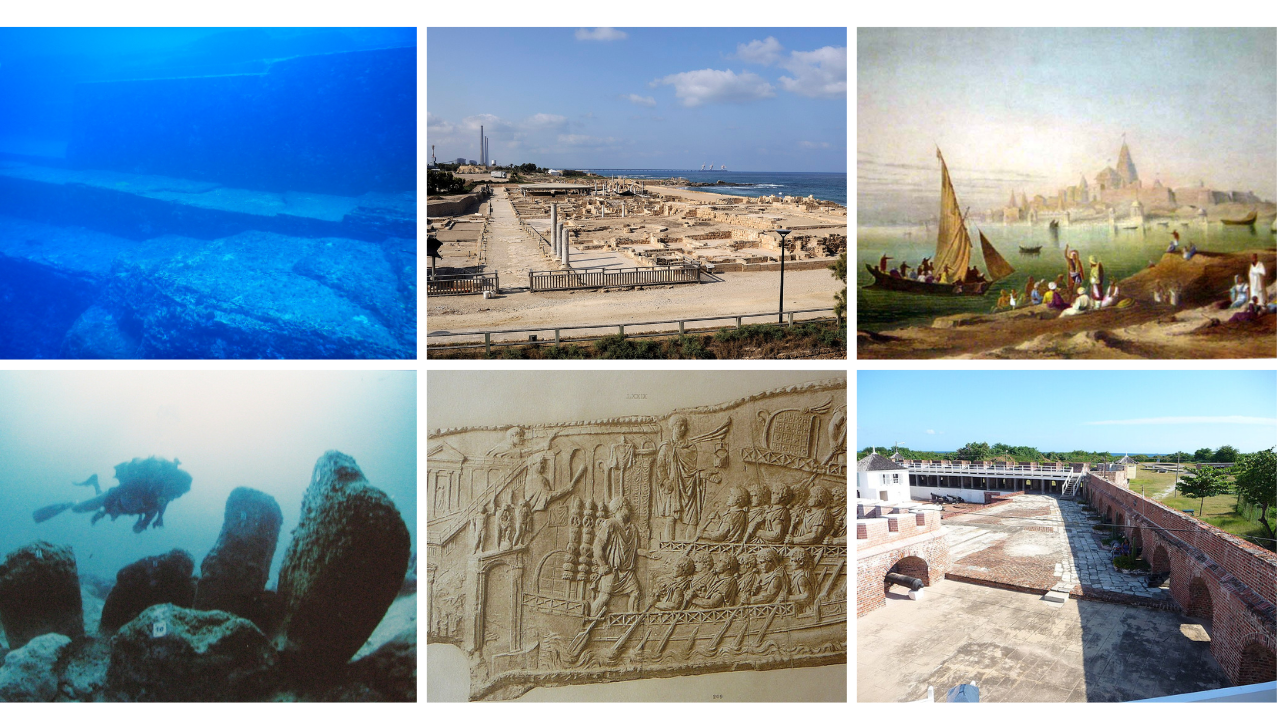
Caesarea Maritima’s Sunken Herodian Harbor
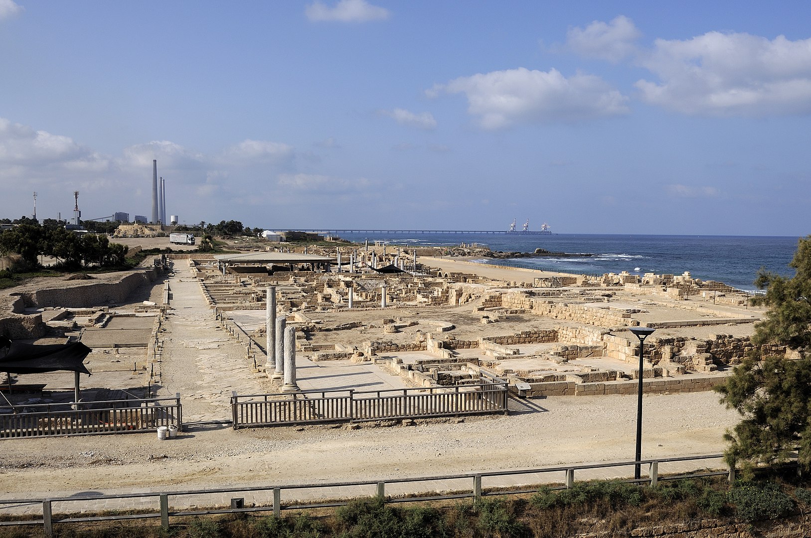
Off Israel’s coast, the remains of King Herod’s ambitious harbor at Caesarea Maritima lie buried in sand and water, where massive concrete blocks once framed a proud artificial port. Roman engineers used volcanic ash to harden structures underwater, allowing ships from across the Mediterranean to dock at warehouses, granaries, markets, and nearby temples. Over time, storms, tectonic shifts, and fierce coastal currents tore the harbor apart, scattering anchor stones, cargo debris, and broken quays, yet the surviving foundations still speak clearly of grand plans humbled by a persistent, changing sea.