
By day, these districts sell confidence: open storefronts, visible patrols, packed sidewalks, and easy transit links. After dark, many of those same blocks change character in less than an hour. Crowds thin unevenly, closed facades create blind stretches, and late movement concentrates near stations, garages, and curbside pick-up points. Police advisories in multiple cities describe this exact transition not as panic territory, but as a predictable shift that rewards planning. That mismatch catches distracted visitors.
The following neighborhoods share one pattern: daytime familiarity can hide nighttime risk at the edges.
Downtown Crossing, Boston, Massachusetts
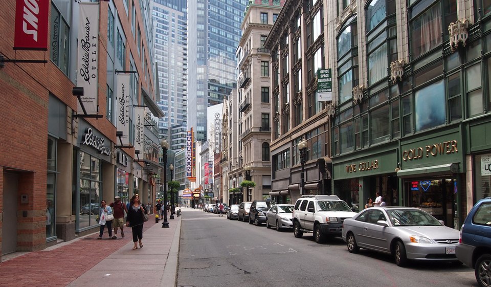
Downtown Crossing moves fast in daylight because offices, stores, and transit lines keep people visible. After dark, that rhythm changes. Closed retail blocks create longer quiet stretches, and the remaining foot traffic often comes in short bursts around station entrances rather than steady streams. That uneven flow is exactly where opportunistic incidents tend to cluster.
The area remains central and active, yet police messaging is consistent: keep moving on primary streets, skip side-cut shortcuts between Washington and Tremont, and avoid lingering near shuttered storefronts after 9 p.m. while checking maps or messages.
Union Square, San Francisco, California
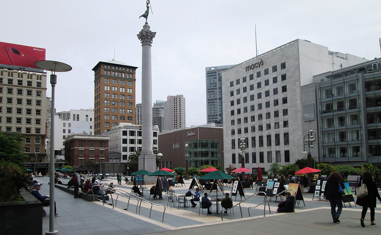
Union Square projects control in daylight: hotels, retail security, and constant street activity around major corridors. At night, the texture changes by the block. Police and city crime maps repeatedly show higher theft pressure around transit approaches and less visible side streets, especially when travelers pause with luggage, shopping bags, or phones out in the open.
The caution here is practical, not dramatic. Stay on bright front-facing routes, avoid drifting onto quieter connectors just to save a minute, and treat station entrances, parking lanes, and hotel curb zones as transition points where attention should stay high.
The Loop South End, Chicago, Illinois
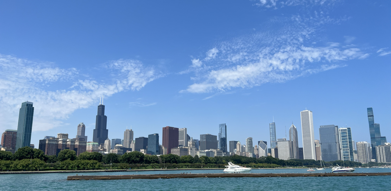
Chicago’s Loop feels orderly when offices, theaters, and commuter traffic overlap. Later, especially on the southern edges, density drops quickly and walking routes become predictable. Police data often points to the same moments: people leaving trains, crossing toward garages, or waiting in thinly populated pockets near exits after event hours. Shift is strongest after 10 p.m.
The district is not uniformly unsafe, but timing changes the risk profile. Local guidance emphasizes limiting long post-event walks, choosing direct rides after late shows, and avoiding extended waits in isolated corners where movement and visibility thin.
Hollywood Boulevard, Los Angeles, California
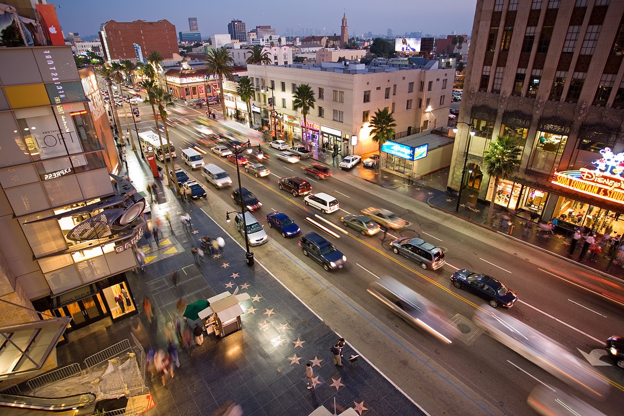
Hollywood Boulevard stays visually loud long after sunset, which can hide how safety conditions shift underneath the crowds. Nightlife traffic, street activity, and visitor distractions compress into short blocks, and city crime data continues to track theft and confrontation patterns tied to dense evening foot flow near transit and parking zones.
What makes this corridor tricky is the illusion of constant oversight. Busy does not always mean protected. Officers advise sticking to well-lit primary stretches, skipping quiet side streets behind the main strip, and moving with purpose instead of stopping in place to navigate plans.
French Quarter Peripheral Blocks, New Orleans, Louisiana
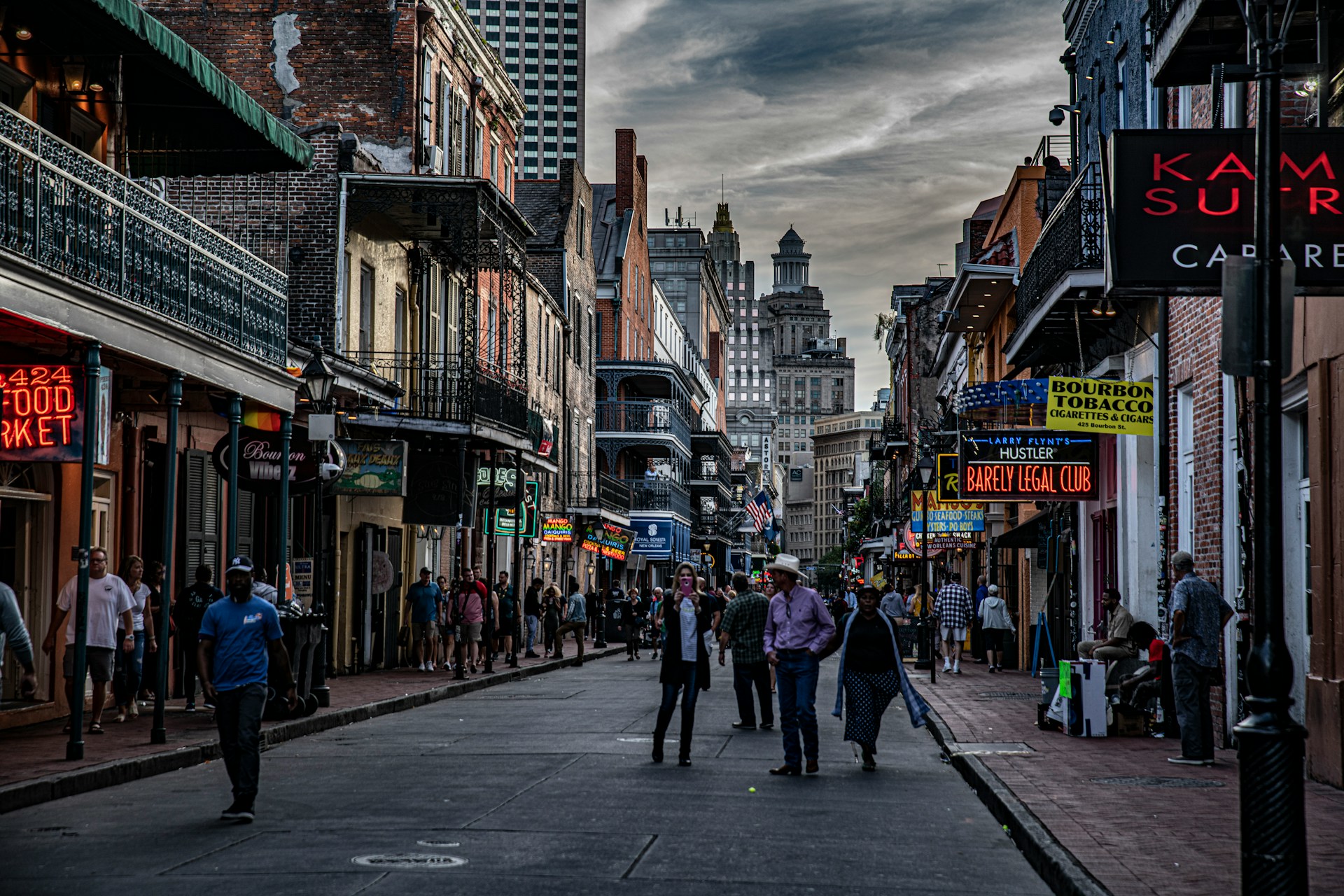
The French Quarter’s core remains one of New Orleans’ most watched visitor zones, yet police warnings often focus on its outer seams after dark. A few streets away from major nightlife corridors, lighting and foot traffic can drop fast, creating transitional pockets where travelers misread distance and take quiet shortcuts.
That edge effect matters more than many expect. NOPD crime tools and safety messaging emphasize that risk rises on fringe blocks where crowds thin, not only inside the busiest party lanes. The safest pattern is simple: use active routes, avoid empty connectors, and keep late-night movement deliberate.
Pike and Pine Corridor, Seattle, Washington
Capitol Hill’s Pike and Pine area reads as social and walkable, especially before midnight when cafés and venues stay active. After closing waves begin, police dashboards often show theft, assault, and disorder calls clustering around bar release times, transit stops, and stretches where people separate from groups.
The pattern is less about panic and more about timing. Large crowds dissolve into smaller streams, and that gap creates openings for snatch theft and conflict spillover. Local advice centers on leaving with companions, using direct routes, and avoiding waits beside closed businesses once foot traffic drops.
South Beach West of Ocean Drive, Miami Beach, Florida
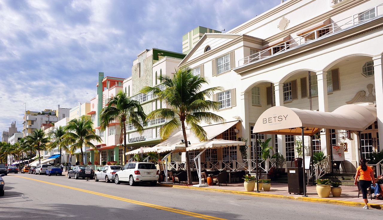
South Beach’s postcard image is built on bright frontage and nonstop energy along Ocean Drive. A few blocks inland, conditions can feel different at night. Miami Beach police dashboards and advisories repeatedly flag theft, assault, and alcohol-linked disputes rising as groups split up and movement shifts away from the main strip.
The issue is predictability. Visitors often wander toward quieter interior streets without realizing visibility and witnesses can thin quickly there. Officers recommend staying on active corridors, avoiding solo cut-throughs after venue hours, and planning pick-up points before nightlife dispersal begins.
Broadway Entertainment District, Nashville, Tennessee
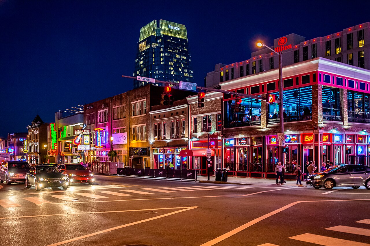
Lower Broadway looks continuously active, which is why many travelers underestimate the after-midnight transition. As venues close, the crowd does not disappear, it surges outward in waves. Metro Nashville crime mapping and public reports frequently show pickpocketing, fights, and robbery concerns peaking during that release window near garages and side connectors.
The underlying risk is bottlenecks mixed with distraction. People are tired, phones are out, and routes become predictable. Police guidance emphasizes leaving before peak spillout, avoiding isolated garage approaches, and choosing clear, well-lit paths with steady flow.
Downtown Mall Area, Charlottesville, Virginia
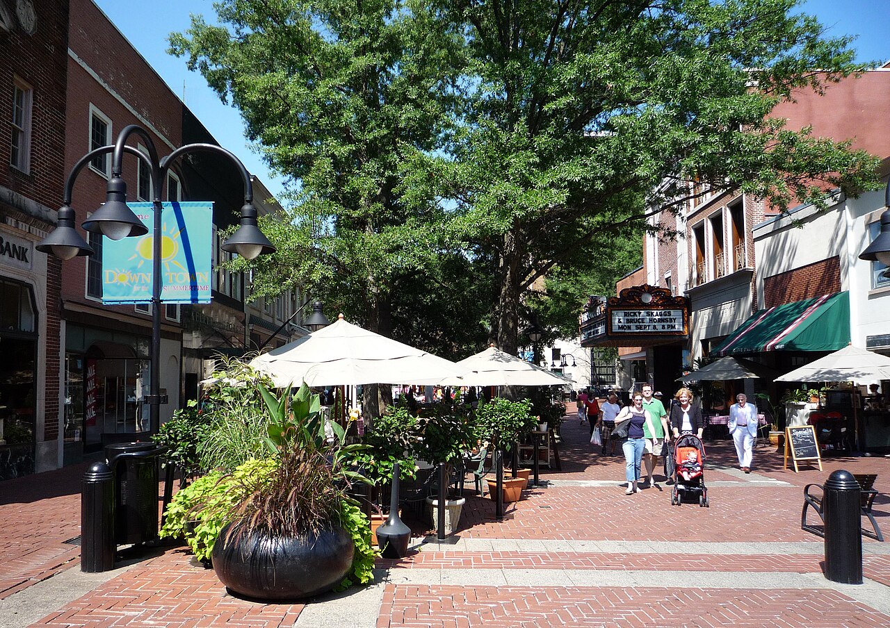
Charlottesville’s Downtown Mall is known for restaurants, culture, and strong street life through dinner. After that window, conditions can change on connecting blocks and parking approaches. City police updates and district meetings have stressed awareness around late-evening disturbances, theft complaints, and isolated conflicts beyond core activity bands.
The challenge here is perception lag. The neighborhood can feel familiar and calm, even as observers drop block by block. Local safety messaging pushes for direct routes, lighting choices, and minimal idle time near lots, garages, and low-traffic connectors once activity thins.
Gaslamp Quarter Outer Blocks, San Diego, California
San Diego’s Gaslamp core is heavily visited and closely managed, but outer blocks can feel different after nightlife peaks. SDPD mapping tools and neighborhood summaries show incident pressure moving toward transition zones where people walk between bars, hotels, parking structures, and ride pick-up points as crowds thin.
This is a classic edge pattern: vibrant center, quieter perimeter, and uneven visibility. Police advisories focus on avoiding long pauses in low-foot-traffic pockets, staying on bright commercial corridors, and resisting shortcut temptations through quieter side streets when returning late to lodging.
Capitol Hill Eastern Sections, Washington, D.C.
Capitol Hill carries a daytime reputation shaped by government institutions, row houses, and steady routine movement. Late hours can produce a different street dynamic, especially east of the busiest avenues, where pedestrian volume falls and visibility changes quickly. MPD data tools and district alerts underline how localized risk can be after dark.
The key point is geography, not alarm. A familiar address can sit near a corridor that empties earlier than expected. Local guidance favors route planning before departure, staying close to active streets, and avoiding waits at low-traffic corners while arranging rides or directions.
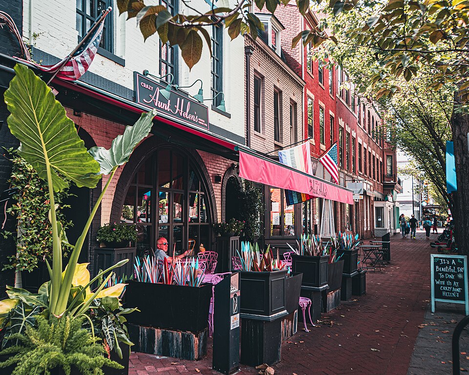
Old Town Fringe Areas, Alexandria, Virginia
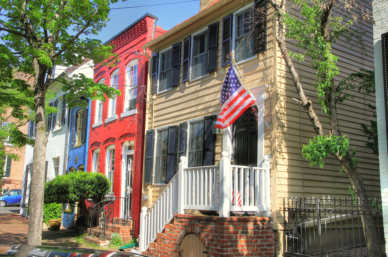
Old Town Alexandria remains one of the region’s most walkable historic destinations, with strong daytime activity near shops, dining, and the waterfront. As businesses close, outer streets and fringe connectors become quieter. Alexandria Police mapping tools reinforce that conditions are not uniform across the district once evening traffic fades.
The difference is where movement concentrates and where it disappears. Fringe blocks may have less lighting, fewer observers, and longer gaps between passersby. Local advisories emphasize staying on active routes, avoiding empty cut-throughs, and limiting phone use in low-visibility zones.