Americans still dream about famous skylines, music districts, and desert horizons, yet trip planning includes a tougher question: where can a memorable vacation turn stressful without warning? Recent police reporting, city dashboards, and emergency data show a more complicated map than postcard marketing suggests. Many places are improving, but risk remains uneven by block, time of day, weather, and infrastructure strain. The safer mindset is not fear. It is informed timing, smarter routing, and practical preparation. That balance shapes how travelers choose where to stay, when to move, and when to head in before dark.
Detroit, Michigan

Detroit has posted meaningful improvement, and recent reporting notes the city reached one of its lowest homicide totals in decades. That progress matters, but it does not erase uneven safety conditions across neighborhoods or late-night transit gaps.
The city’s public crime viewer shows why route planning matters block by block. Lodging near active corridors, using direct rides after evening events, and limiting unplanned detours remain common recommendations in local safety briefings.
Detroit is a city in transition: stronger than a few years ago, yet still requiring practical timing and location awareness at night.
St. Louis, Missouri

St. Louis carries a strong tourism pull, from baseball weekends to the Gateway Arch, and city police reports show notable crime reductions in 2025. Even with that progress, the department still publishes weekly CompStat data and district-level trends because conditions can shift from one corridor to the next.
For visitors, the main issue is often overconfidence after busy daytime sightseeing. Long walks through quiet blocks late at night, especially after events, create avoidable exposure.
Staying near active streets, using planned transport, and treating neighborhood boundaries seriously keeps a good trip from turning tense.
Oakland, California
Oakland remains culturally vibrant, yet policing and safety offices publish frequent incident reports and neighborhood dashboards for a reason. Citywide progress has been reported, but property theft and street incidents still cluster in pockets, including commercial zones that attract out-of-town traffic.
Visitors sometimes assume proximity to San Francisco means similar street patterns and risk profiles. It does not. Parking habits, visible luggage, and poorly chosen late stops can change the experience fast.
Oakland rewards preparation: secure transport, minimal valuables in vehicles, and tighter movement plans after dark.
Death Valley National Park, California

Death Valley is the clearest example of non-urban travel risk. National Park Service climate pages note summer highs often exceed 120°F in the shade, with overnight heat that stays punishingly high. Park updates in 2024 documented record-setting monthly and seasonal heat, reinforcing how little margin exists for mistakes.
Heat illness can escalate quickly, especially when visitors underestimate distance, skip water planning, or hike during peak sun. Rescue operations do happen, but extreme conditions can slow response.
In this landscape, timing is safety: early movement, shaded stops, and strict hydration discipline.
New Orleans, Louisiana
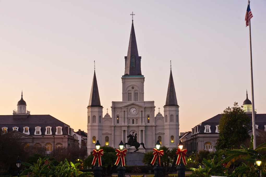
New Orleans offers unmatched food, music, and street life, but risk here is a two-layer issue: neighborhood crime variability and environmental exposure. City crime mapping tools and police reports help track local conditions, while hazard planning documents underline how often tropical weather threatens the metro area.
NOLA Ready materials, built on NOAA history, describe a high annual chance of tropical cyclone impact. That does not mean every trip faces a storm, but disruptions can appear quickly during active seasons.
Smart itineraries in New Orleans depend on current alerts, neighborhood research, and flexible plans.
Memphis, Tennessee
Memphis has reported notable declines in major crime categories, and city leadership highlights those gains through public dashboards updated often. Even so, the same tools show why visitors cannot treat the whole city as one safety zone, especially after dark or outside entertainment corridors.
The local risk pattern is less about headline fear and more about timing, transport, and street-level awareness. Unplanned late movement between districts raises uncertainty faster than many first-time visitors expect.
Memphis works best when itineraries stay intentional, rides are prearranged, and nightlife returns are tightly planned.
Baltimore, Maryland
Baltimore has shown substantial progress in recent police reporting, including year-end reductions across major offense categories. Yet the city still maintains public crime maps and open datasets, reinforcing a practical truth: improvement and exposure can exist at the same time, often within short distance.
Beyond street safety, Baltimore emergency guidance highlights flood vulnerability tied to shoreline and watershed geography. Weather-linked disruptions can compound mobility issues during heavy rain events.
Balanced planning in Baltimore means reading neighborhood patterns and watching local weather with equal seriousness.