Deep under Yellowstone’s calm forests and geysers sits a volcanic system powerful enough to change the shape of the American West. Scientists have modeled what a modern supereruption might look like, tracking pyroclastic flows, ash plumes, and wind patterns across several states. The results are uncomfortable to imagine: small gateway towns erased in minutes, larger cities buried so deeply in ash that daily life could never resume. Thinking through those scenarios highlights how closely communities are tied to the land beneath them.
West Yellowstone, Montana
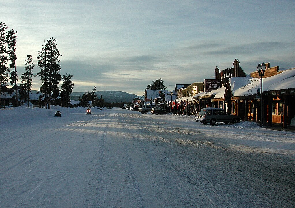
West Yellowstone sits just a few miles from the caldera’s western edge, which effectively places the town at ground zero. Federal hazard maps put it inside the inner impact zone where temperatures and flow speeds leave no realistic chance of survival. Pyroclastic clouds would move faster than highway traffic, carrying ash, rock, and gas hot enough to strip away buildings and forests in minutes. The familiar grid of lodging, diners, and gear shops would vanish under meters of debris.
Mammoth Hot Springs, Wyoming
Mammoth Hot Springs serves as the administrative heart of Yellowstone National Park, with housing, offices, and historic lodges clustered around fragile terraces. That convenient base for rangers and visitors also sits directly atop the volcanic system. In a supereruption, vents, blasts, and collapsing ground would converge on this area within moments. Pyroclastic surges would overrun roads and structures so quickly that evacuation would not keep pace. The headquarters that organizes park protection would be erased along with the landscape it manages.
Gardiner, Montana
Gardiner stands at Yellowstone’s northern doorstep, framed by steep hills and the iconic stone arch that welcomes travelers. Its beauty comes from that tight valley setting and its closeness to the park boundary. Those same traits increase its risk. In eruption models, pyroclastic flows funnel through low-lying terrain and river corridors, exactly the kind of route that leads straight toward town. Superheated gases and ash would overwhelm buildings, bridges, and utilities in minutes, leaving little trace of the historic gateway community.
Livingston, Montana
Livingston feels a step removed from Yellowstone, about 50 miles away and surrounded by big-sky ranchland and railroad history. Distance alone, however, does not guarantee safety when dealing with a volcano of this scale. Scientific work shows pyroclastic flows traveling more than 60 miles, especially when guided by valleys and open plains. The town’s position along the Yellowstone River makes it part of that pathway. Within roughly an hour of a major blast, currents of hot ash could sweep through and flatten much of the community.
Jackson Hole, Wyoming
Jackson Hole is known for its steep peaks, art galleries, and high end real estate, not for volcanic risk. On a clear winter day, the Teton Range feels like a separate world from Yellowstone’s plateau. Modeling suggests those mountains would not form a true shield in a supereruption. Ash clouds and fast moving flows can spill over divides and race along basins. Ski resorts, hotels, and homes scattered across the valley floor would face intense heat, collapsing roofs, and deep ash deposits that make rebuilding nearly impossible.
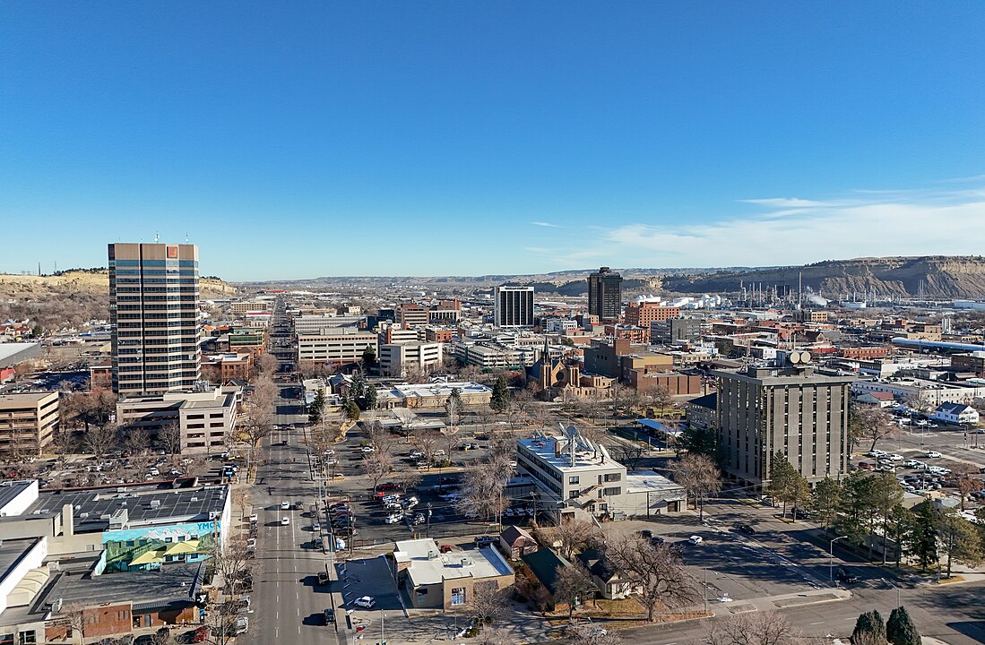
Billings, Montana
Billings sits well outside any projected zone for pyroclastic flows, which can give a false sense of security. The real danger here comes from ash. USGS work points to the city as a prime target for heavy accumulation, with estimates reaching well over a meter in some scenarios. That amount would crush many roofs, clog every air filter, and contaminate water systems across the metro area. Streets, rail lines, and runways would disappear under a dense, cement-like layer, leaving the largest city in Montana unlivable.
Casper, Wyoming
Casper lies roughly 155 miles southeast of Yellowstone, yet modeling still puts it in a category of extreme ash burial. Studies describe depths from tens of centimeters to more than a meter, enough to collapse structures and end normal movement through the city. Industrial sites and refineries that currently anchor the local economy would be vulnerable to fires, leaks, and long term damage as ash infiltrates equipment. With air thickened by glassy dust and infrastructure failing in sequence, a permanent evacuation would become the only rational outcome.
Boise, Idaho
Boise, set on the western side of the region, feels removed from Yellowstone’s immediate orbit, yet it sits along a corridor that could collect dense ash. USGS simulations project several inches to nearly a foot of fine, abrasive material across the area. Even the lower range is enough to halt traffic, ground aircraft, and overload power systems. Heavier deposits would push flat roofs past their breaking point and overwhelm water treatment plants. The active downtown, tech scene, and outdoor culture would be replaced by a long struggle just to breathe and move.
Salt Lake City, Utah
Salt Lake City stretches along the Wasatch Front in a broad valley that already traps winter smog and summer heat. In a Yellowstone supereruption, that geography would hold volcanic ash as well. Some projections describe depths approaching a meter across the urban corridor. First floor windows would vanish behind gray drifts. Roads and rail lines would become unusable. Key institutions, from religious archives to research labs, would face long term burial or damage. Even if structures could be cleared, air and water quality would keep long term life there doubtful.
Denver, Colorado
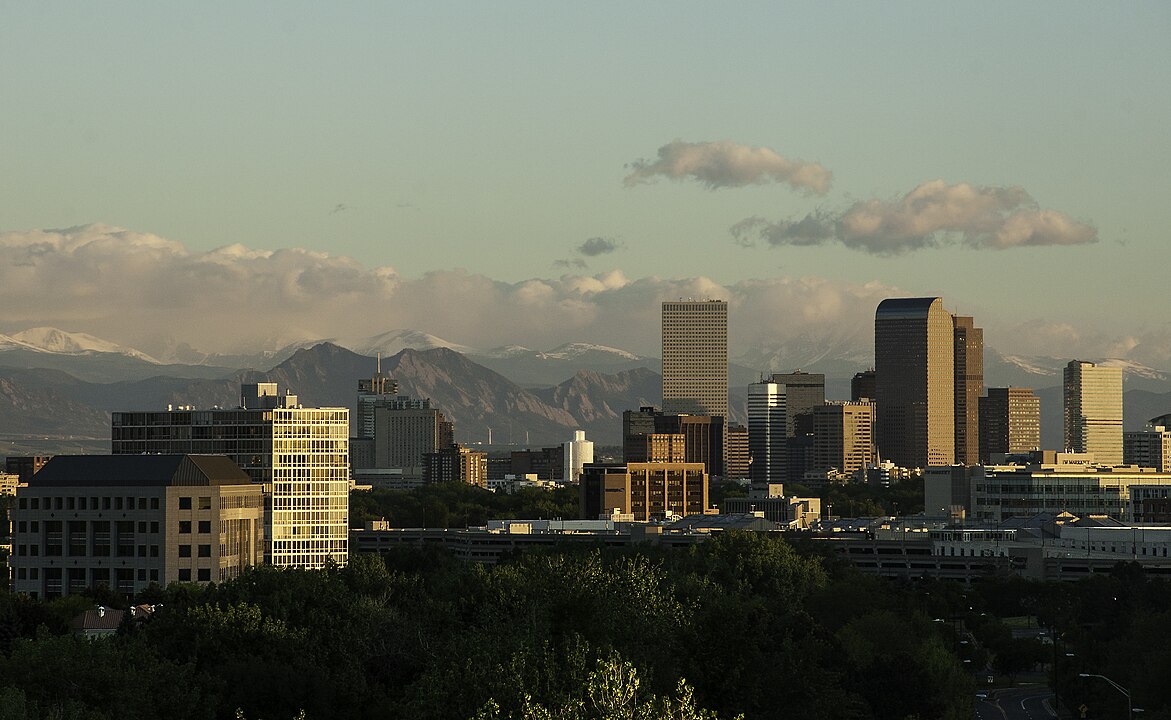
Denver sits more than 500 miles from Yellowstone, but strong westerly winds would carry ash across the Rockies and onto the High Plains. Studies suggest anywhere from several inches to multiple feet of accumulation, depending on storm tracks and eruption strength. Ash would reach the metro area within a day, closing the airport, weighing down commercial roofs, and choking rivers that now serve as drinking water sources. The city’s role as a transportation and economic anchor for the interior West would disappear beneath a slow moving, regional disaster.