Long streets do more than move traffic. They link markets to homes, coastlines to capitals, and daily errands to the wider map. Measured in miles they impress, but their real power shows up curbside where buses stop, vendors open, and neighbors cross. Each route below mixes history with utility, tying culture to geography in a way that guidebooks often miss. Follow the line and a city’s logic comes into focus, block by block and day by day. Taken together, these routes show how distance becomes daily rhythm.
Sukhumvit Road, Bangkok, Thailand
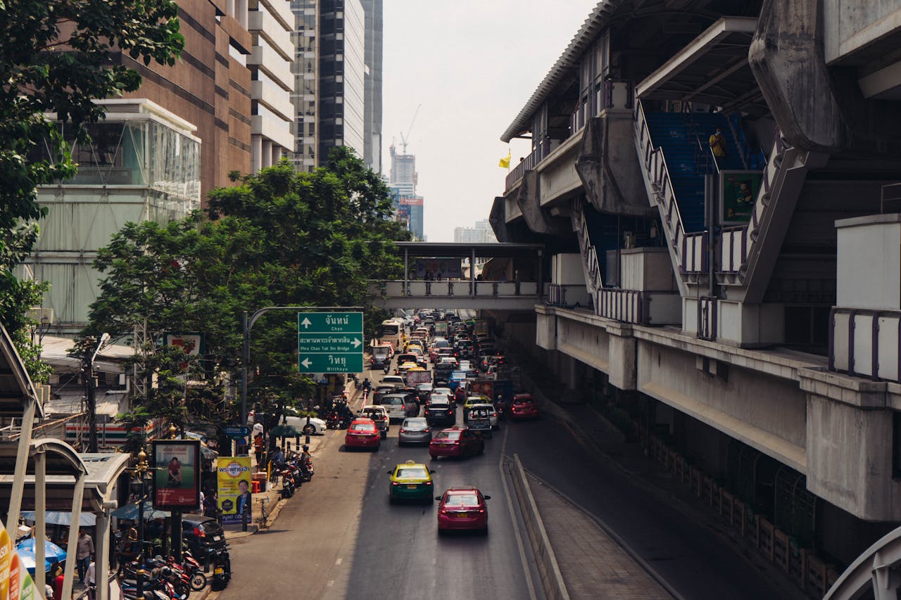
Sukhumvit Road runs about 305 miles from the capital to the Cambodian border, doubling as a commercial spine and an interprovincial link. Inside Bangkok, stations for the skytrain shadow the pavement while hotels, markets, and malls cluster at key junctions. Beyond the city, the road threads coastal provinces like Chonburi and Rayong, tying factories, beaches, and ports to the metropolis. Food stalls turn over by hour and small sois keep the scale human at every stop.
Moscow Automobile Ring Road (MKAD), Moscow, Russia
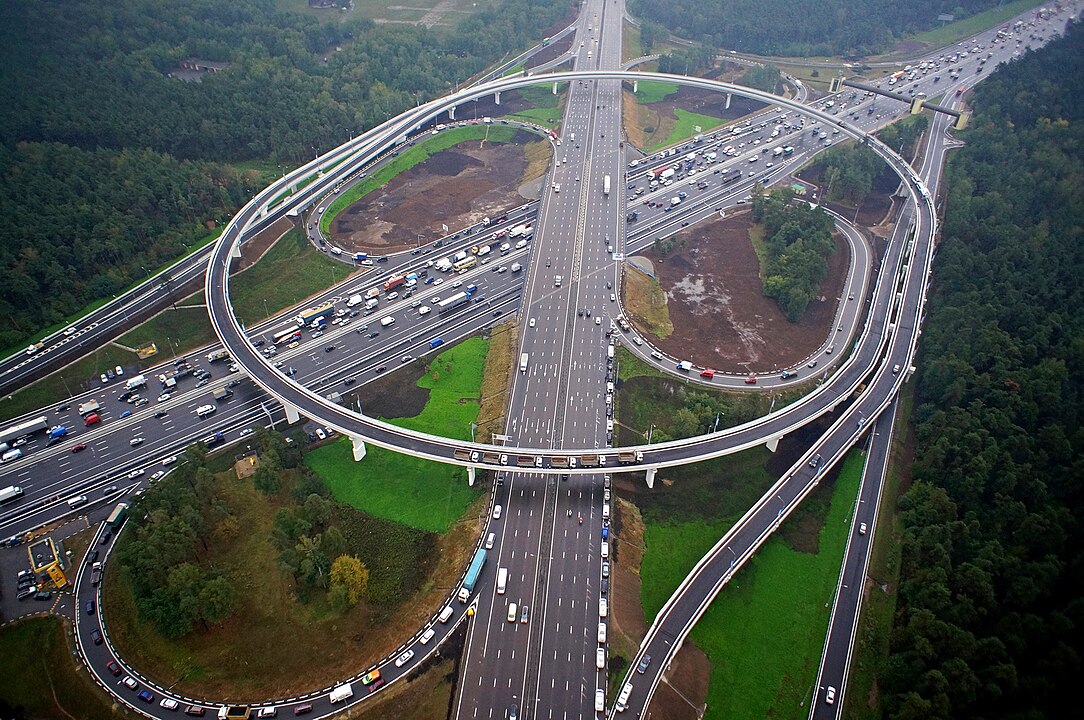
The MKAD loops Moscow for about 67.7 miles, a controlled access belt that keeps cross town trips from choking the center. Dozens of exits feed industrial zones, new suburbs, and towering blocks, turning the ring into a living atlas of expansion. Freight, buses, and commuters share regulated speeds that trade spectacle for reliability, the quiet math that makes a capital function, especially during winter storms when detours and plows move in cadence with the loop.
Colfax Avenue, Denver Metro, Colorado, USA
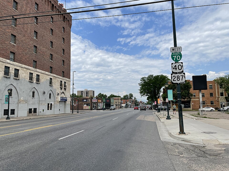
Colfax Avenue stretches 49.5 miles from the plains to the foothills, carrying statehouse crowds, concert lines, and commuters on one axis. Neon, motels, theaters, and diners punctuate blocks that also hold new apartments and transit lanes. The street is often called the nation’s longest commercial strip, but its charm is simpler: a continuous story of how Denver grew along the Front Range, where parades, protests, and everyday errands share the same pavement.
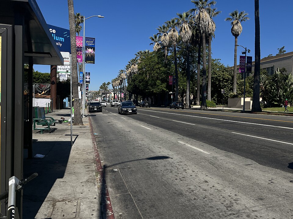
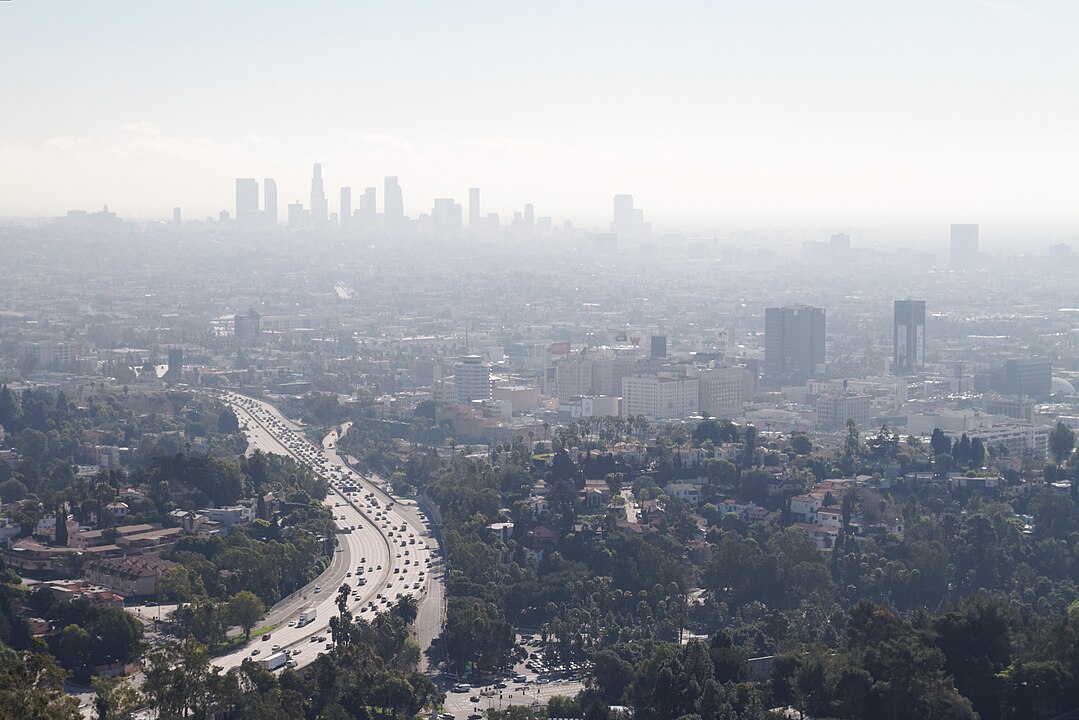
South Sepulveda Boulevard, Los Angeles, California, USA
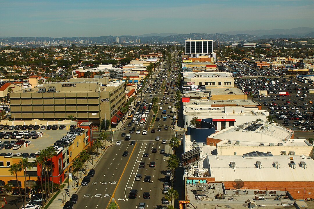
South Sepulveda runs about 42.8 miles across Los Angeles, crossing canyons, business parks, and airport ramps in a single sweep. It passes the Getty Center, skims the edge of West L.A., and dives toward LAX before continuing to coastal flats. Across its length, buses, cyclists, and carpools thread gaps that open and close with rush hour, turning a practical artery into a moving snapshot of workdays and weekend plans from valley neighborhoods to sea air.
Broadway, New York City, USA
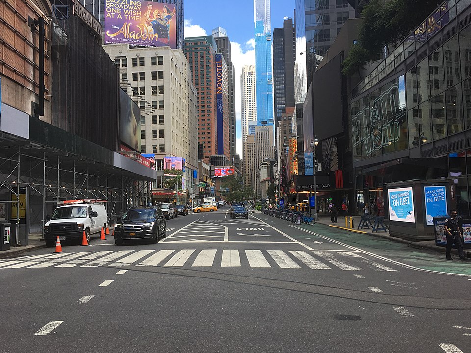
Broadway travels more than 33 miles from lower Manhattan through the Bronx and into Westchester, tracing a path older than the grid. It is theater shorthand near Times Square, then a neighborhood spine past campuses, parks, and markets. The same name carries finance at one end and everyday errands at the other, linking ferries, subways, and parks into a continuous thread. Street musicians and bookstores keep the edges human. The cadence shifts by block with a steady spine.
Western Avenue, Chicago, Illinois, USA
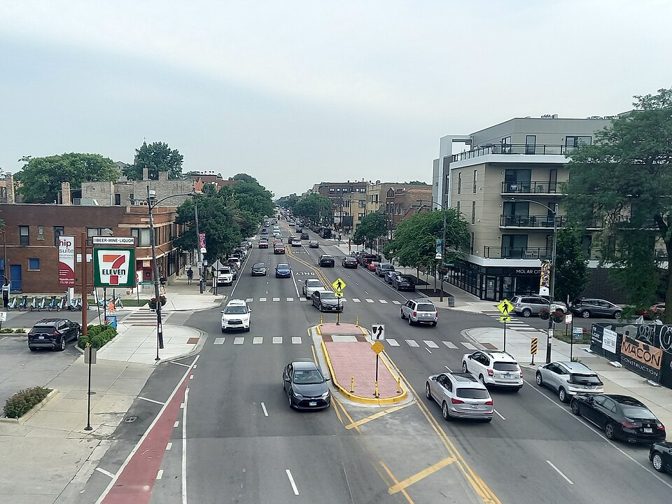
Western Avenue runs roughly 29 miles along Chicago’s spine, once the city’s edge and now a survey of neighborhoods from Beverly to Bucktown. Auto rows, taquerias, and corner bars share blocks with brick flats and old yards, while bus routes stitch the length together. Landmarks like the 95th Street Bridge and the corridors of small manufacturers anchor the drive, turning a crosstown errand into a rolling lesson in how the city fits.
Sunset Boulevard, Los Angeles, California, USA
Sunset Boulevard travels about 23.6 miles from downtown to the Pacific, shifting from studios and music clubs to hillside curves and ocean light. The Strip draws night crowds, while quieter segments reveal hotels, schools, and palm lined neighborhoods. The commute brushes fame without stopping for it, folding daily errands into a route that has framed more scenes than any tour, the city telling on itself in morning glare and evening glow. It is spectacle and routine sharing the same lane.
Rivadavia Avenue, Buenos Aires, Argentina
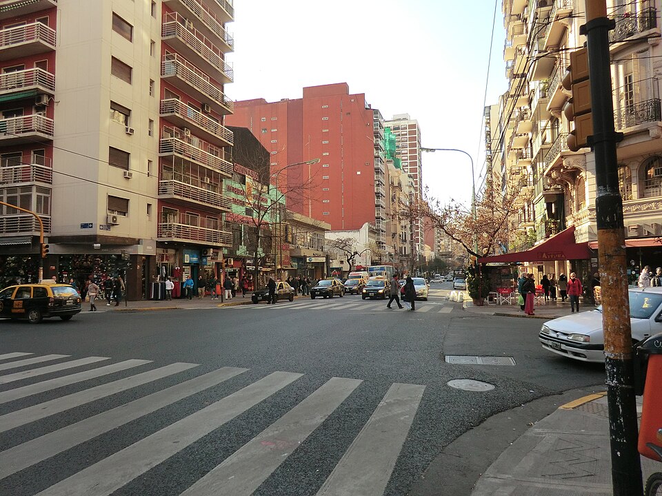
Rivadavia Avenue spans about 23 miles across Buenos Aires, running from congressional chambers and plazas to residential barrios. Subway and bus lines shadow long stretches, so the rhythm changes block by block, fast at noon and unhurried by evening. Shops, cafes, and theaters tie the civic to the everyday, and the avenue’s reach makes it an easy way to read the capital’s layers, from tango halls to bookstores and late dinners. Crowds thin after rain, and the smell of coffee travels a long way.
Mulholland Drive, Los Angeles, California, USA
Mulholland Drive snakes for about 21 miles along the Santa Monica Mountains and Hollywood Hills, a ridge road with wide views. Pullouts frame the Hollywood Sign and grid below, while bends thread water tanks, chaparral, and canyon homes. The name lives in pop culture, yet the asphalt serves locals too, a shortcut between valleys that turns rush hour into a moving postcard, often at dusk when headlights draw a necklace along the ridge. Wind and silence do most of the talking on clear nights.
Avenida de los Insurgentes, Mexico City, Mexico
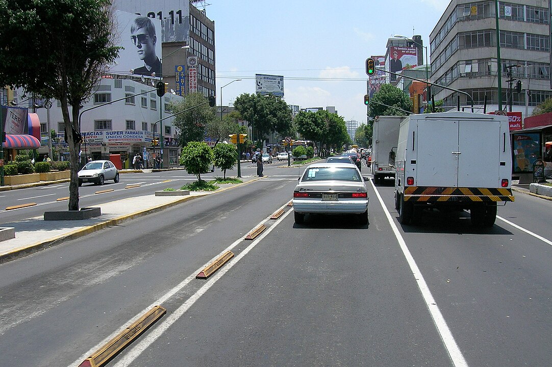
Avenida de los Insurgentes runs about 17.9 miles from the city’s north to El Caminero in the south, lined with campuses, museums, and offices. Bus Rapid Transit keeps the flow steady while neighborhoods change in quick succession, from historic hubs to new business nodes. Murals, markets, and food stalls animate the corridor, turning a long commute into a cross section of the capital’s day, with mariachi horns and rallies mixing into the noise. Rain slows traffic, but the avenue rarely sleeps.
Sofiyskaya Street, Saint Petersburg, Russia
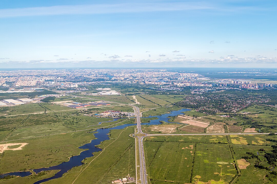
Sofiyskaya Street extends about 11 miles across the southern districts, linking large housing estates to logistics yards and retail centers. The architecture leans practical, a mix of Soviet era blocks and newer complexes that grew around major junctions. Connections to the Moscow and Kolpino highways keep freight moving while schools, markets, and parks sit just off the main flow, turning a long corridor into the everyday backbone for thousands.
Moscow Avenue, Saint Petersburg, Russia
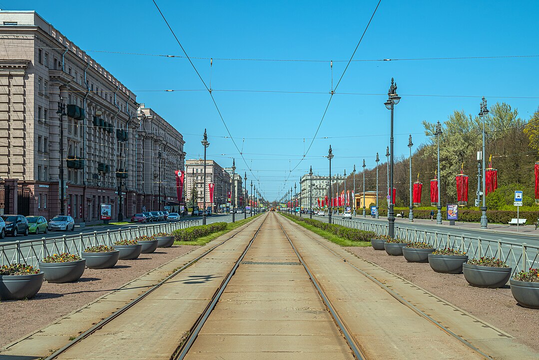
Moscow Avenue runs roughly 6 miles from the center toward the southern edge along a planned axis of squares and parks. Stalin era monuments define key stretches, including Moskovskaya Square and the House of Soviets, while Victory Park adds green to the line. The route balances ceremony and routine, hosting parades one day and commuter buses the next, an avenue that handles symbolism and errands with equal ease. Evening light softens the stone, and wide sidewalks keep the pace unhurried.