Across U.S. waters, a handful of islands live in a strange kind of secrecy. They show up on charts and in news stories, yet access is blocked by private owners, military rules, or strict wildlife protections. Some guard fragile bird colonies; others carry legacies of weapons tests, disease labs, or older cultural promises that still stand. Together they form an invisible coastal border, where curiosity is held back on purpose so that safety, science, and tradition can take the lead.
Niihau, Hawaiʻi’s Closed Community
Niihau sits just off Kauai, close enough that its low outline often shows on clear days, yet it might as well be a different world. Privately owned since the 19th century, it remains home to a small Native Hawaiian community that lives with limited outside contact and strong use of the Hawaiian language. Landing is restricted to residents, invited guests, and a few carefully arranged work or hunting trips, keeping the island’s culture and landscape under tight, deliberate protection.
Plum Island, New York’s Science Zone
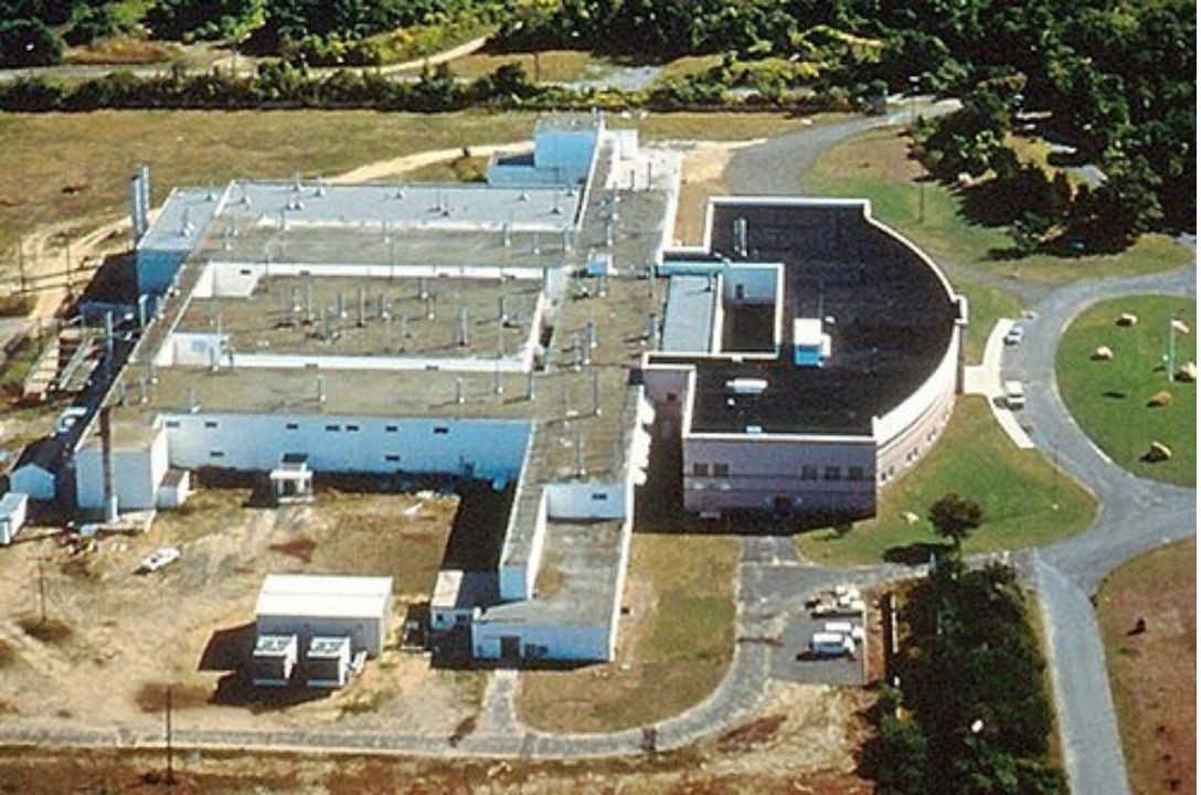
Plum Island sits off the tip of Long Island’s North Fork, a green shape wrapped in fences, warning signs, and a long history of scientific work. Since the 1950s it has hosted the Plum Island Animal Disease Center, where researchers study serious livestock illnesses inside high security labs, far from major farms. Public visits are barred, with access limited to cleared staff and official guests. As the lab gradually moves to Kansas, conservation groups are pushing for a future that favors wildlife and low key public use instead of private development.
Farallon Islands, California’s Off Limits Wildlife Refuge
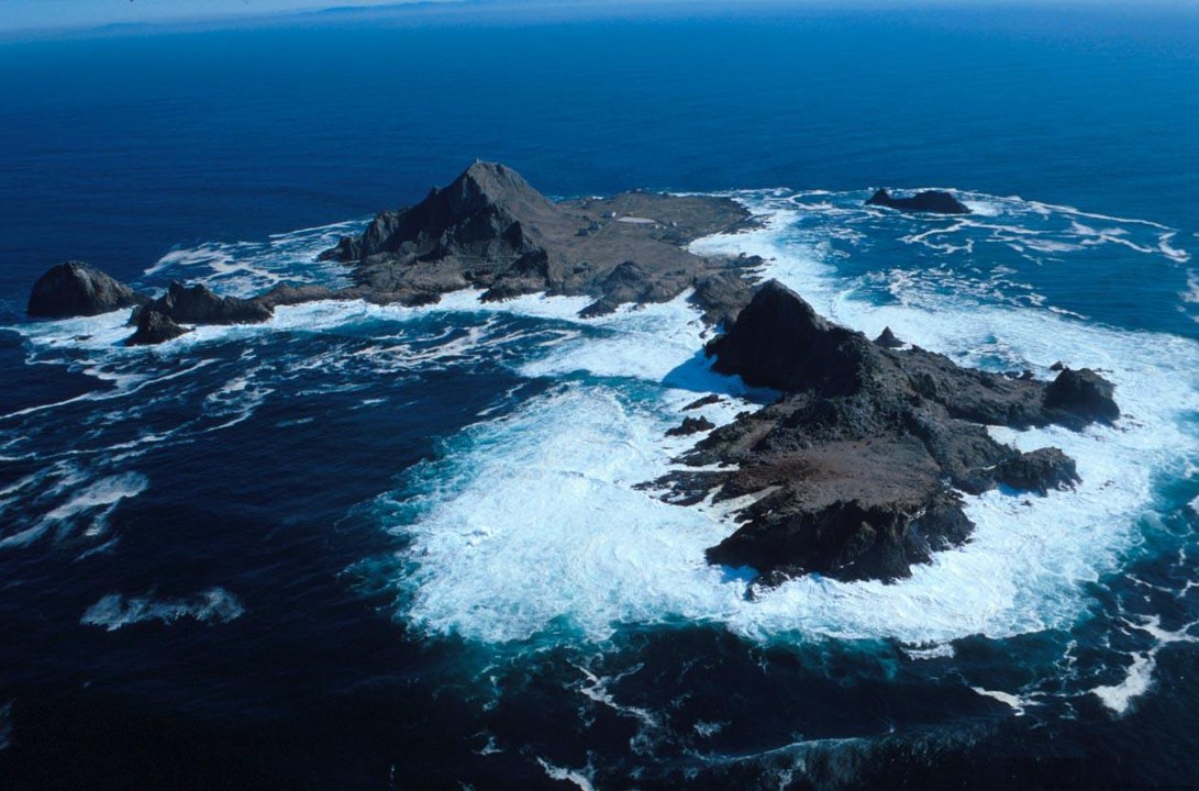
The Farallon Islands rise like jagged stone teeth from the Pacific, about 30 miles off San Francisco, often wrapped in fog and rough water. They support huge colonies of seabirds and seals, with great white sharks hunting in the surrounding currents. To protect those crowded cliffs and nesting ledges, the Farallon Islands National Wildlife Refuge is closed to the public, with only small research teams landing under permit. Whale watching and nature trips circle at a distance, leaving the rocks themselves to storms, scientists, and a noisy community of wild residents.
Desecheo Island, Puerto Rico’s Hazard Marked Refuge
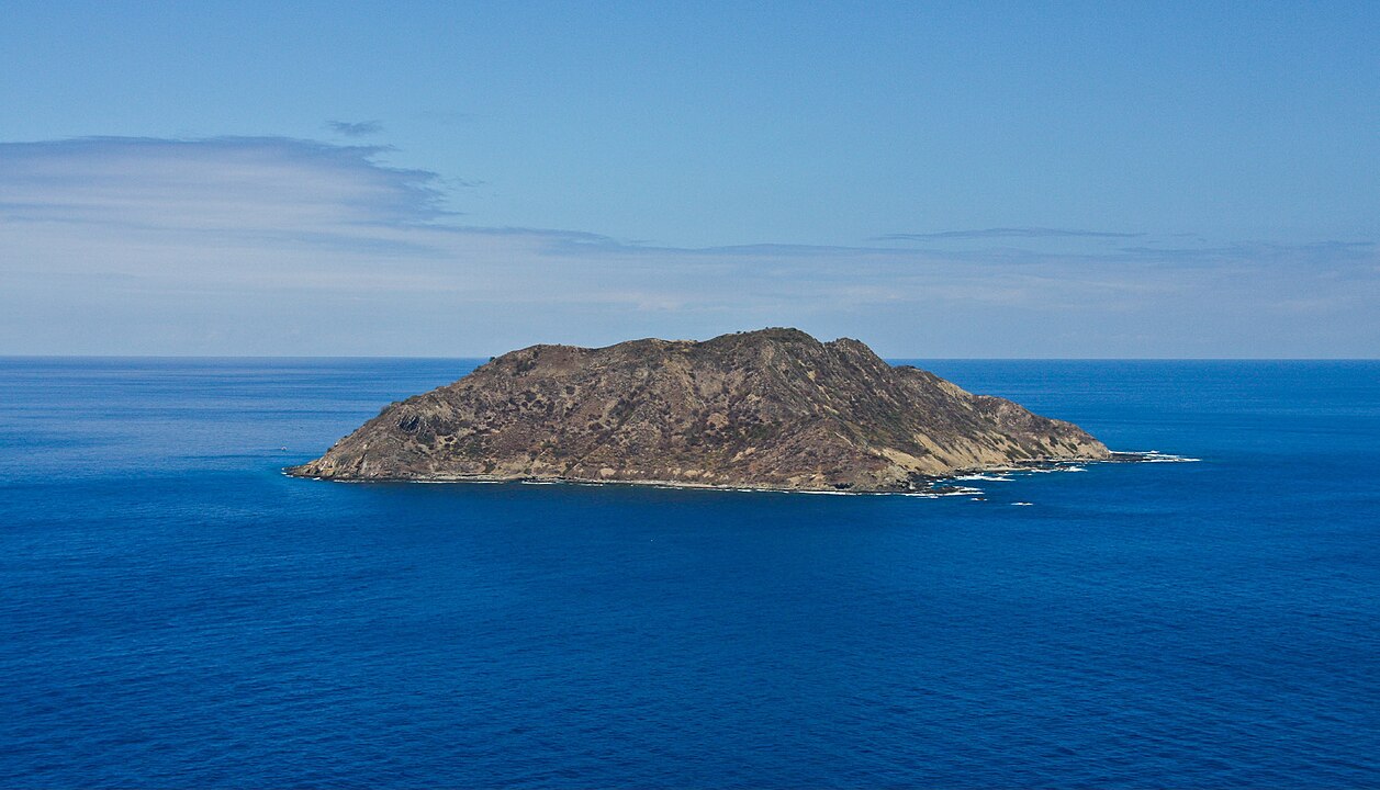
Desecheo Island looks like a classic tropical lump of rock in the Mona Passage, surrounded by blue water and bright coral. Its slopes once hosted military training, and unexploded ordnance still hides in the soil and cliffs, mixed with recovering seabird habitat. The U.S. Fish and Wildlife Service manages it as a National Wildlife Refuge that is formally closed to the public, with only highly controlled staff or research trips allowed. Diving on nearby reefs is possible from permitted boats, but the island’s interior remains off limits for both safety and conservation.
Navassa Island, Sheer Cliffs And Strict Rules
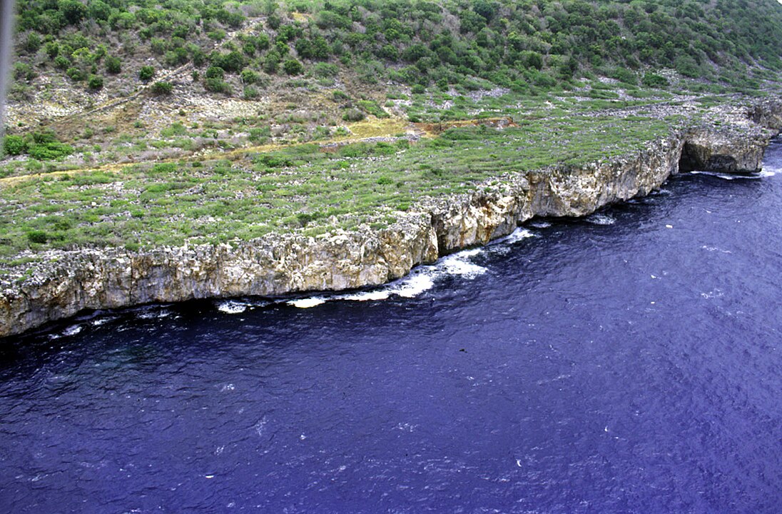
Navassa Island lies between Haiti and Jamaica, a steep plateau of limestone that rises straight from deep water, with almost no safe landing spots. It is managed as Navassa Island National Wildlife Refuge, protecting seabird colonies, coral reefs, and a handful of endemic reptiles. Because of hazardous coastal cliffs and the need to preserve habitat, the refuge is closed to the general public, and even entry into its waters requires permission that is rarely granted. For most people, Navassa stays a name on a chart and a distant shape seen only from passing ships.
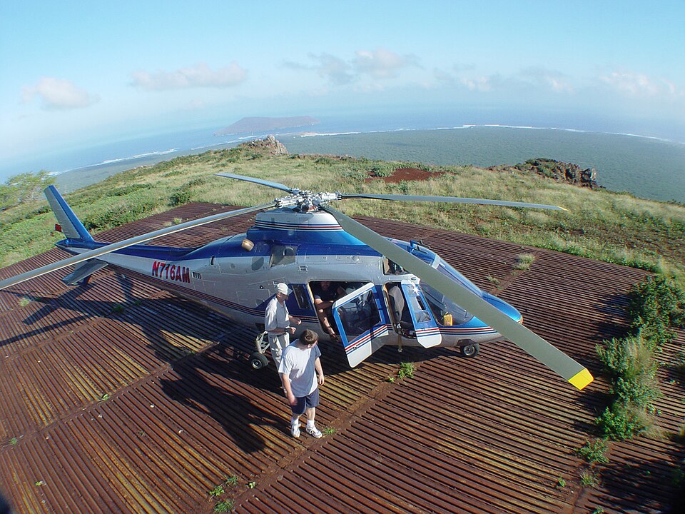
Johnston Atoll, Remote Pacific Testbed Turned Refuge

Johnston Atoll sits alone in the central Pacific, a small ring of sand and runway that carries a heavy military and environmental history. For decades it hosted nuclear tests, missile projects, and chemical weapons storage, leaving contamination that required extensive cleanup work. Today it is a National Wildlife Refuge under U.S. Air Force jurisdiction, home to large seabird colonies inside a wide marine protected area. The atoll is closed to public entry, and even scientific access needs special use permits and military authorization, keeping human presence rare and tightly supervised.
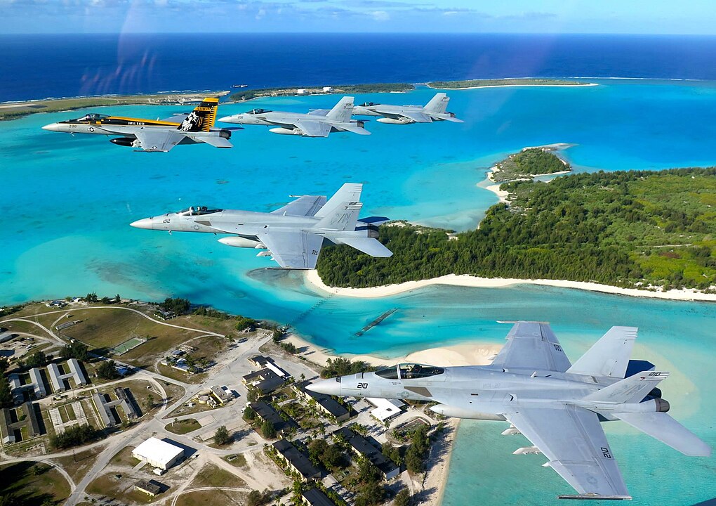
Wake Island, Military Outpost In Open Ocean

Wake Island forms a rough triangle of coral in the north Pacific, remembered for a brutal World War II battle and used later for missile tests and emergency landings. It now functions as a U.S. Air Force installation with a small rotating population of personnel and contractors who maintain the airfield and support defense activities. Access is restricted; visitors need official clearance, and there is no tourism infrastructure or casual anchoring allowed nearby. For most travelers, Wake exists only as a waypoint underneath long transpacific flight paths.
San Nicolas Island, California’s Closed Test Range

San Nicolas Island is the most distant of California’s Channel Islands, low, windy, and ringed by steep bluffs that face open Pacific swell. Unlike neighboring park islands, it is controlled by the U.S. Navy and used as a weapons testing and training range, complete with restricted waters and an outlying airfield. Regulations establish a no access buffer around the shore and explicitly prohibit landing without authorization. Only military staff, contractors, and a few approved researchers visit, which has the side effect of sheltering rare plants and wildlife from heavy public pressure.