Risk takes many forms, from volatile geology to fragile cultures and active conflict. Some destinations sit behind legal buffers because science, sovereignty, or public safety demands it. Curiosity is natural, but context matters more. These places carry histories of loss, near misses, and hard lessons that shaped strict rules. Local stewards, scientists, and security forces work there with training and purpose. Most travelers honor that line, learning the stories without crossing into harm’s way.
North Sentinel Island, India
Out in the Bay of Bengal, the Sentinelese live with intent, rejecting contact since colonial incursions left injury and trauma. Indian law sets a wide exclusion zone and patrols keep boats away, not to punish outsiders but to protect a small community from disease and intrusion. The risk cuts both ways. Approach invites violence, while a single cough could be catastrophic on shore. After a fatal landing in 2018, enforcement tightened, anchoring a clear message rooted in survival.
Ilha da Queimada Grande, Brazil
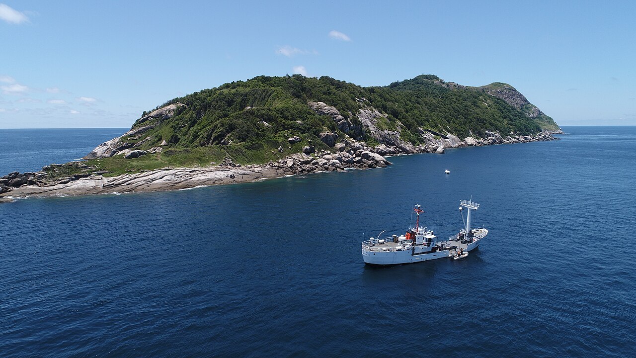
Snake Island’s cliffs hold one of the densest populations of vipers on earth, an isolated lineage with potent venom and little fear of humans. Brazil bars visitors except for permitted scientists with medics on call, because a misstep among vines and rocks can end fast. The old lighthouse stands empty, wrapped in lore of keepers who fled. Keeping people out protects both the snakes and the rescuers who would brave rough Atlantic water to respond.
Chernobyl Exclusion Zone, Ukraine
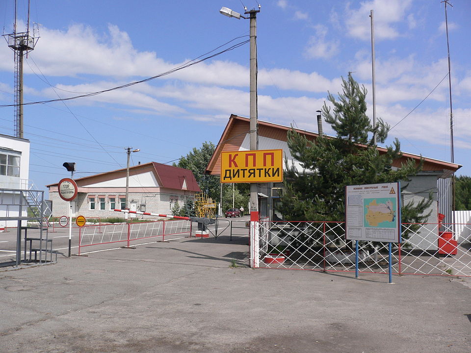
The 1986 reactor explosion scattered radionuclides across forests, marshes, and concrete, leaving hot spots that maps cannot fully tame. Years of regulated tours threaded lower risk paths, yet the hazard remains uneven and stubborn. Since 2022, military activity and damaged monitoring have added new unknowns. Pripyat’s peeling murals tempt cameras, but the real work is containment measured in decades, with fires that loft ash and dose the wind. Casual visits cannot mirror that discipline.
The Darién Gap, Panama and Colombia
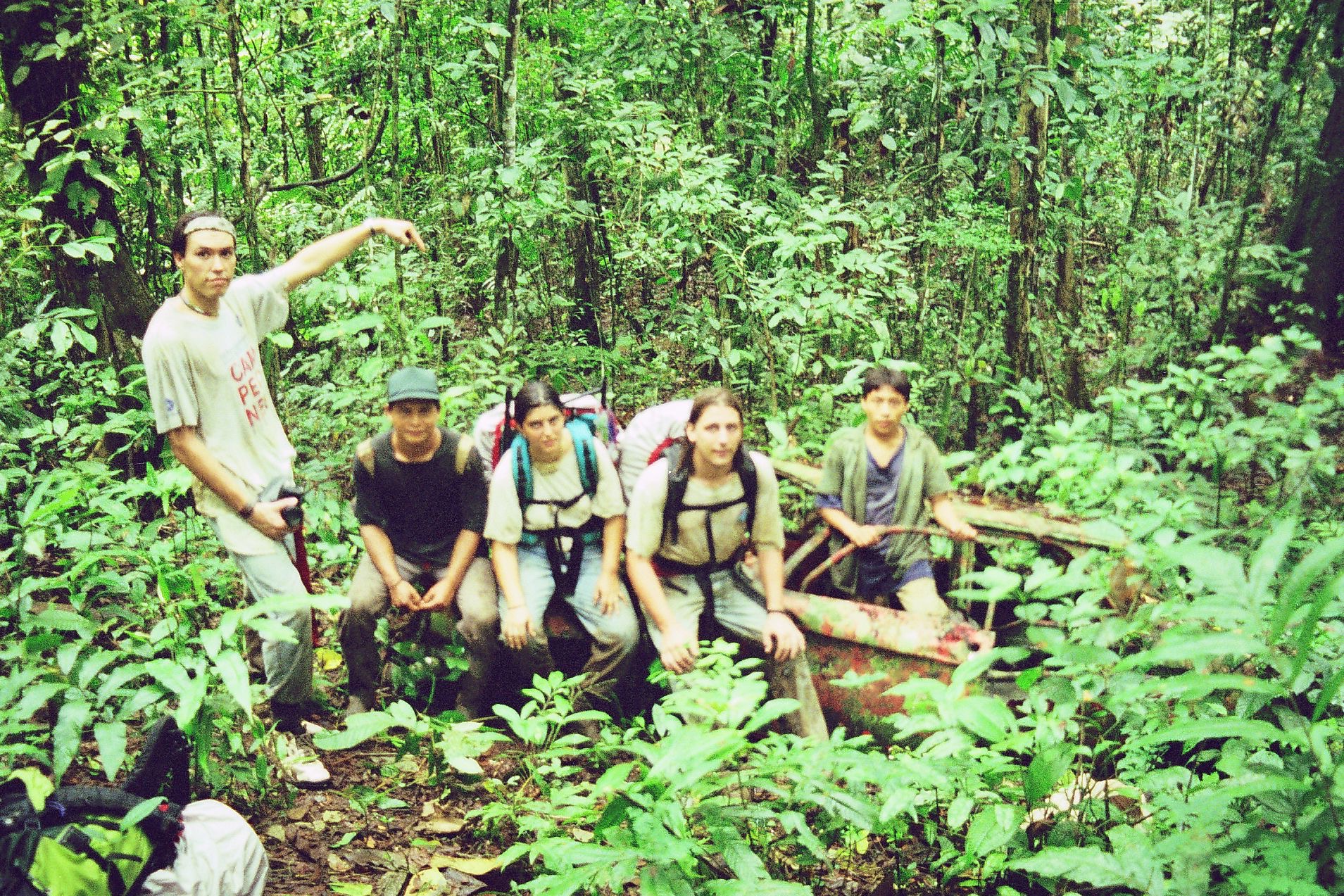
Between road networks lies a tangle of rainforest ridges, deep swamps, and fast rivers that defeat easy routes. It is also a corridor for migrants and a theater for armed groups, where extortion and violence compound the strain of heat, insects, and injury. Engineers paused the Pan American Highway here for ecological and practical reasons. Rangers and medics see the daily toll. Recreational crossings promise adventure on paper, then meet a sobering reality.
Danakil Depression, Ethiopia
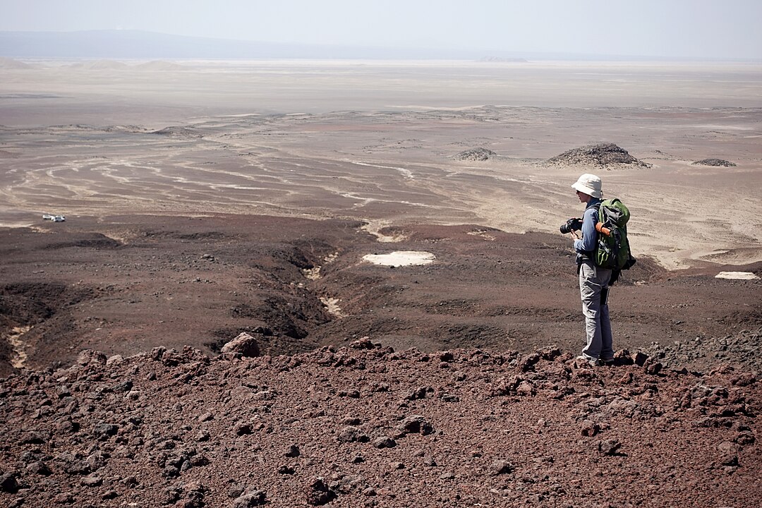
Below sea level, Danakil glows with alien color. Acid springs hiss, sulfur fumes drift with the wind, and salt crust fractures underfoot to reveal brine. Summer heat often clears 115°F, testing judgment and lungs. Afar camel caravans know the routes, and research teams study volcanic chemistry with masks and monitors. Political tensions and sporadic banditry add layers that guides must weigh. It is beautiful and hostile at once, a place that demands caution and respect.
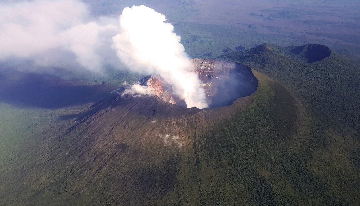
Mount Nyiragongo and Goma, DR Congo
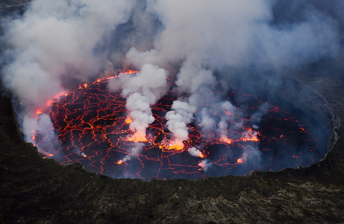
A restless lava lake once dazzled trekkers at midnight, then drained in hours in 2002 and again in 2021, opening fractures that sent flows toward busy neighborhoods. Toxic gas, ash, and quakes strain an already fragile region, where rangers and volcanologists watch cracks and murmurs with limited tools. Trails shift with each crisis. Security concerns complicate access. The spectacle is real, but so is the risk to residents and responders when the mountain moves.
Zone Rouge, Northeastern France
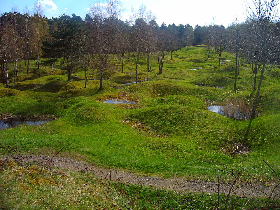
In quiet woods and fields, a century of buried munitions and arsenic still shapes boundaries the public rarely sees. After World War I, authorities fenced off the worst zones, and deminers still collect shells by the ton after storms. Soil holds heavy metals, trees fail without warning, and a farmer’s plow can lift a corroded surprise. Villages stand nearby with memorials and tidy lanes. The land asks for patience that outlasts a lifetime and honors the dead.