Risk wears many faces: boiling salt pans, silent radiation, restless volcanoes, and roads cut into cliffs that shed rock without warning. Some places tempt curiosity while demanding deep respect, shaped by geology, isolation, or the long wake of human experiments. Guides exist, rules exist, and still the margin for error stays thin. What follows is a portrait gallery of hazard, where awe and caution share the frame and survival relies on patience, planning, and a clear read of the ground beneath each step.
Danakil Depression, Ethiopia
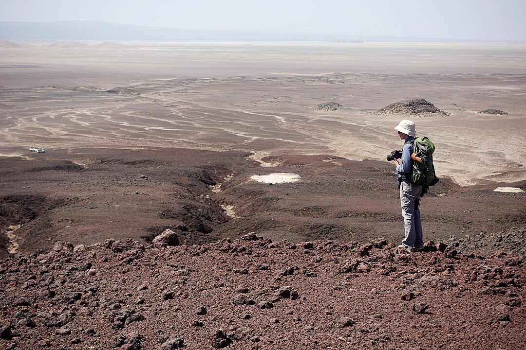
The Danakil Depression sits below sea level in Ethiopia, a tectonic cauldron of salt flats, neon hydrothermal pools, and thin crust over magma. Air temperatures flirt with 120°F, brines can burn skin, and toxic gases gather in windless pockets. Miners and researchers know the rules here: move early, mind the vents, and never trust the ground to hold. Beauty arrives with risk, painted in sulfur, halite, and heat that punishes hesitation. Even vehicles and radios fail more quickly, reminding visitors that chemistry, not comfort, sets the terms.
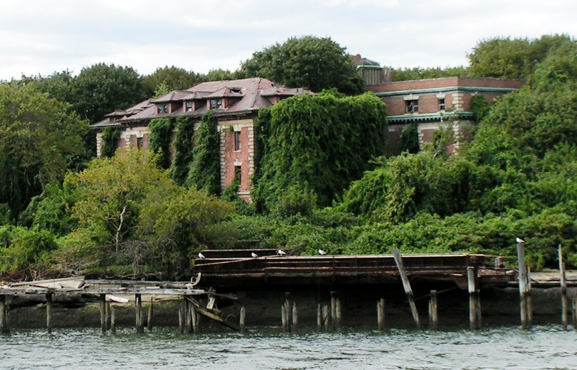
North Sentinel Island, India
North Sentinel Island in India’s Andaman Sea remains off-limits, protected both for the Sentinelese and for outsiders. Shallow reefs, rough surf, and a fiercely isolated community make approach dangerous; contact risks disease for inhabitants with no immunity. Indian law enforces a buffer zone, and patrols turn boats away. From offshore, the island reads as a green fortress, a reminder that survival here depends on distance, not access, and on respecting a culture that has chosen silence.
Snake Island, Brazil
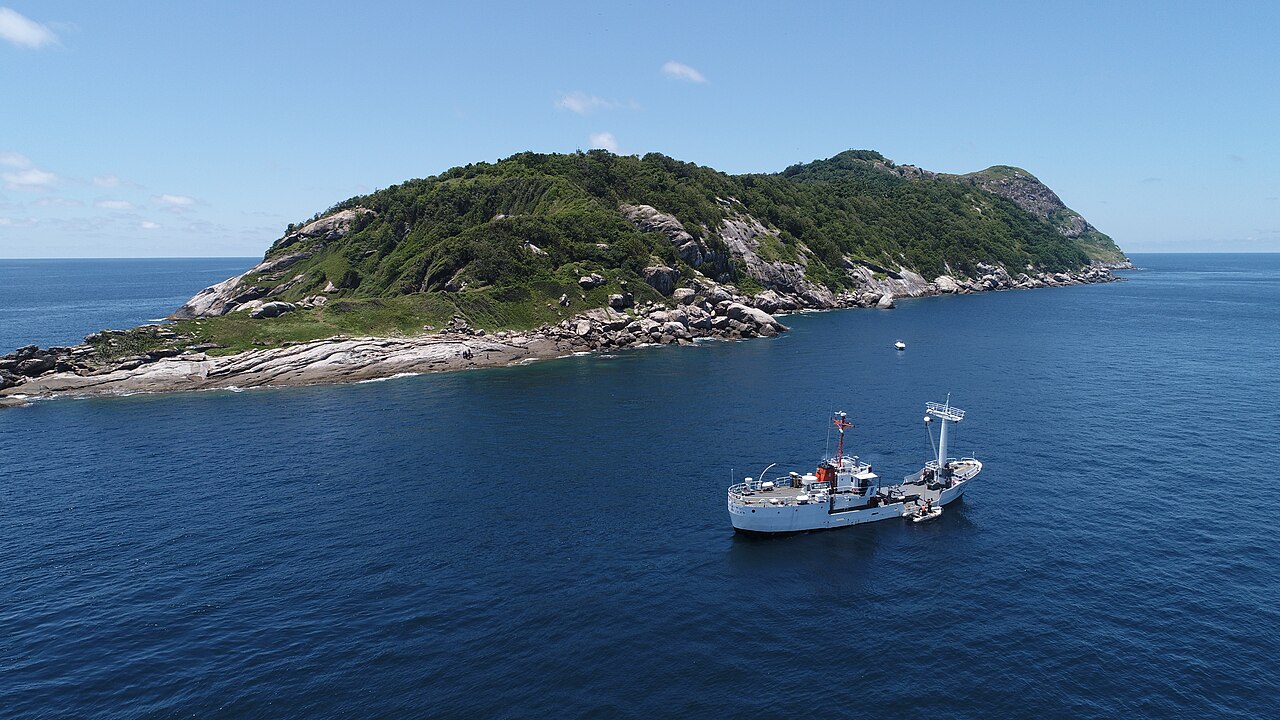
Off Brazil’s coast, Ilha da Queimada Grande, known as Snake Island, hosts thousands of golden lanceheads, a highly venomous viper found nowhere else. The Brazilian Navy restricts landings, and research teams operate under strict permits. Dense brush, slick rock, and a food chain tuned to migratory birds keep risk high even for experts. Legends exaggerate the numbers, but the point stands: this is the reptiles’ refuge, and human curiosity stays safest at sea’s edge.
Chernobyl Exclusion Zone, Ukraine
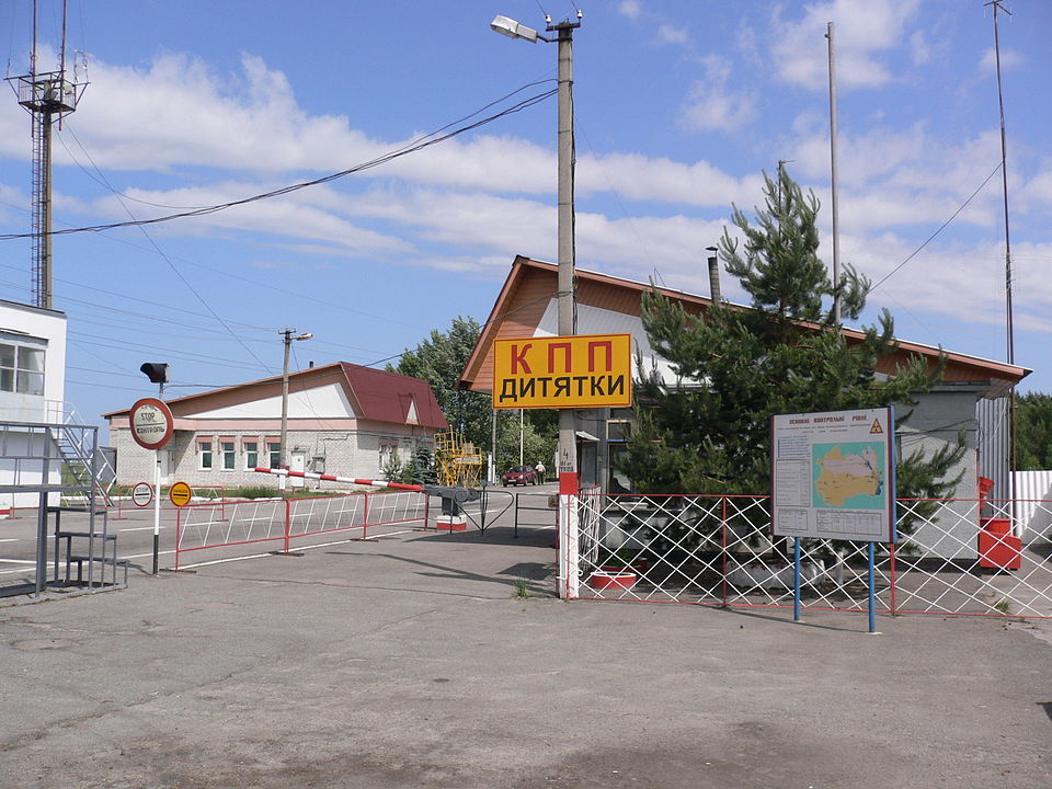
The Chernobyl Exclusion Zone north of Kyiv preserves the long shadow of a 1986 reactor accident. Radiation hotspots persist, structures decay, and forests reclaim neighborhoods, creating hazards that aren’t always visible or stable. Licensed guides follow mapped routes and dosimetry, yet risk rises with trespassing, looting, or time spent near contaminated debris. Wildlife thrives in the absence of people, a paradox that underscores how recovery can outpace safety for those who attempt to wander unprepared.
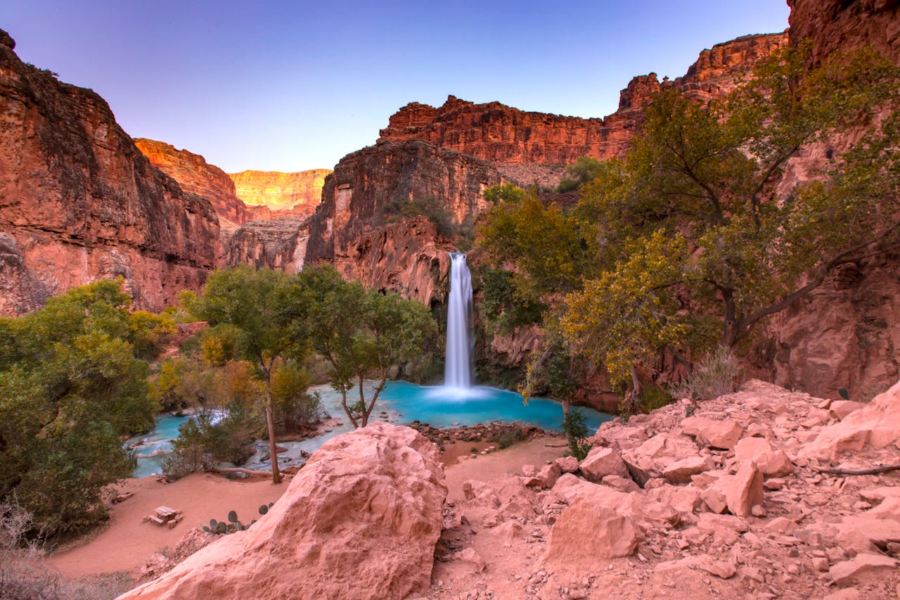
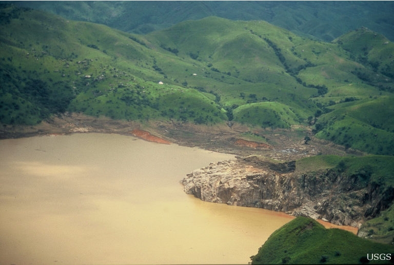
Lake Natron, Tanzania
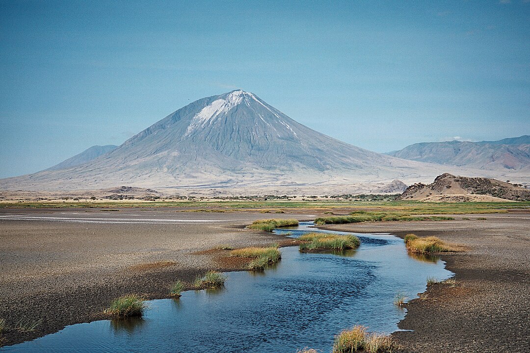
In northern Tanzania, Lake Natron’s shallow waters reach caustic alkalinity and skin-scalding temperatures as evaporation concentrates minerals. The soda lake can calcify small animals, and windblown dust stings eyes and lungs. Flamingos nest by the millions on safe flats, but channels shift and crusts break, turning firm ground to caustic mud within a few steps. Photography made the lake famous; locals know it as a place where respect is practical, not poetic.
Khumbu Icefall, Nepal
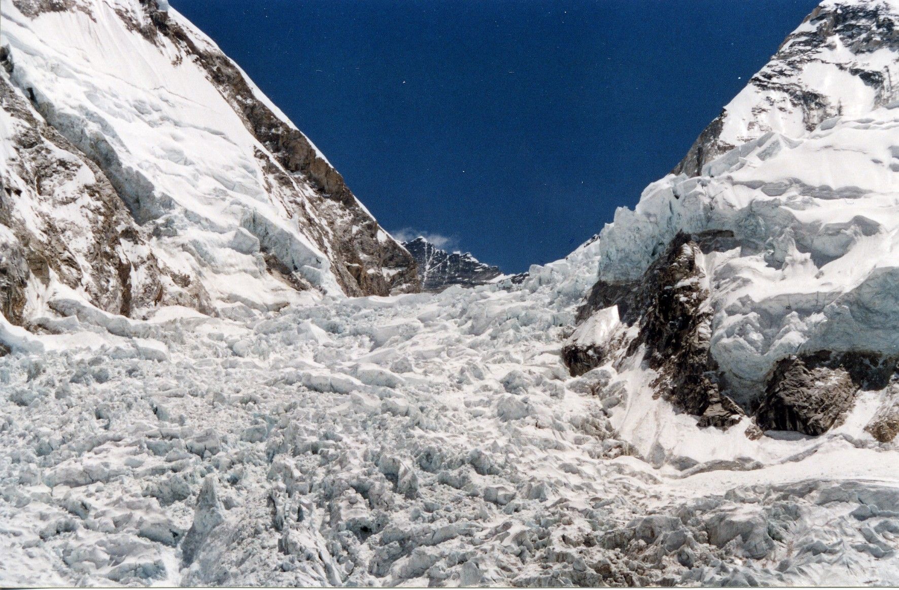
The Khumbu Icefall on Mount Everest moves like a slow river, cracking and toppling towers of ice without warning. Climbers cross before sunrise on ladders and fixed lines, racing the day’s heat that destabilizes seracs. Crevasses hide under wind-packed snow, and rescue at altitude is limited and risky. Every season, Sherpa teams carve a safe path, yet the icefall’s rules never change: speed, discipline, and luck decide who passes and who turns back.
North Yungas “Death Road,” Bolivia
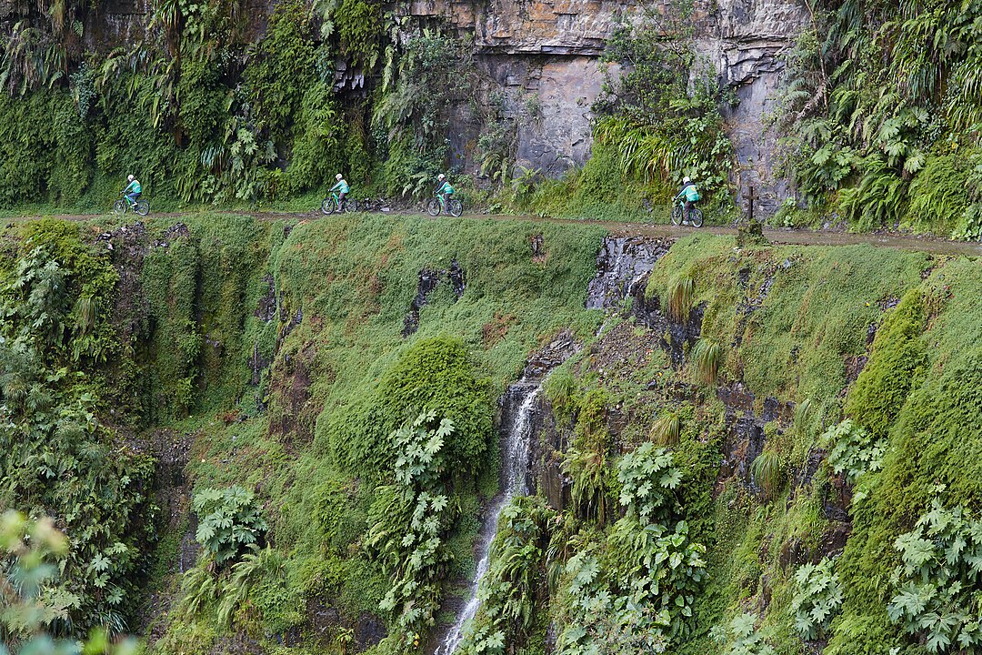
Bolivia’s North Yungas Road, once the main link between La Paz and the rainforest, earned the nickname Death Road for its cliffside drops and fog. Rain, waterfalls, and loose rock narrow the shelf to peril, while drivers meet head-on with inches to spare. A newer highway took most traffic, but cycling tours still trace the old route. Brakes overheat, visibility vanishes, and guardrails are rare, turning a scenic descent into a test of judgment and mechanical nerve.
Mount Nyiragongo, DR Congo
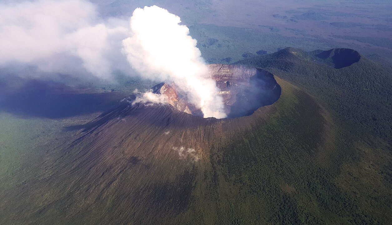
Mount Nyiragongo in eastern Congo holds one of Earth’s largest persistent lava lakes, a cauldron of fluid basalt that can drain catastrophically. Eruptions in 1977 and 2002 sent fast-moving lava toward Goma, and activity in 2021 reminded residents that the hazard remains close. Tremors, toxic gases, and unstable crater rims complicate any approach. From a distance the orange glow fascinates; up close the mountain’s pace can shift in minutes, leaving little time to react.
The Blue Hole, Egypt
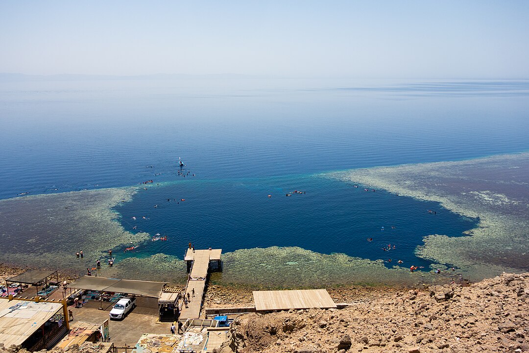
Near Dahab in Egypt, the Blue Hole drops to great depth just offshore, with a famous arch that tempts skilled divers beyond recreational limits. Nitrogen narcosis clouds judgment, currents mislead, and gas planning leaves little margin at 300 feet. Memorials line nearby rock in quiet testimony. For freedivers and technical teams with training and support, it is a proving ground; for the unprepared, it has earned its reputation the hard way. Surface beauty hides a maze of depth, physiology, and time that punishes even small mistakes.
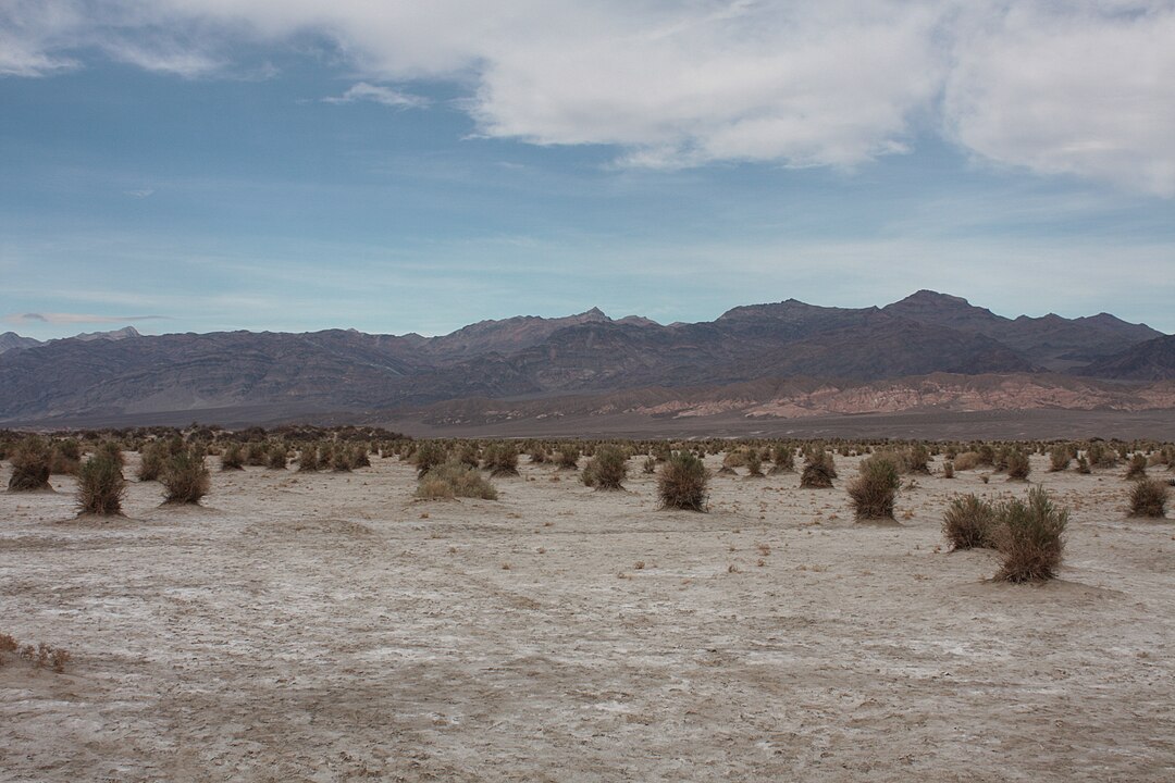
Death Valley, United States
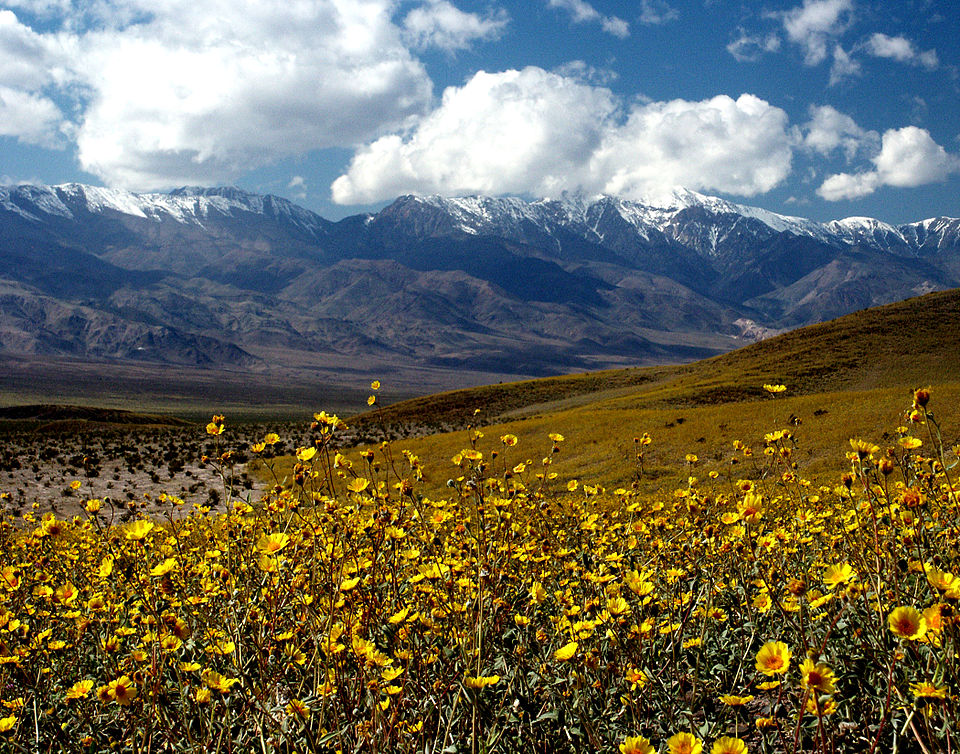
California’s Death Valley records world-beating heat, where summer highs top 125°F and rock faces radiate like stoves after sundown. Dehydration arrives fast, tires fail on searing pavement, and cell coverage fades across long salt flats and alluvial fans. Flash floods carve canyons with little warning after distant storms, stranding vehicles in minutes. Rangers advise routes and water loads, but the landscape sets the pace, rewarding early starts and punishing bravado.
Lake Nyos, Cameroon
Lake Nyos in Cameroon sits atop volcanic vents that can charge deep water with dissolved carbon dioxide. In 1986, a sudden overturn released a dense CO₂ cloud that suffocated villages down-valley. Degassing pipes now vent the lake, but the geology remains capable of refueling the trap. The shoreline feels pastoral until the mechanism is explained, a reminder that some risks are invisible, heavy, and moving downhill on their own timetable. Monitoring continues, yet caution stays part of local memory and planning.
Bikini Atoll, Marshall Islands
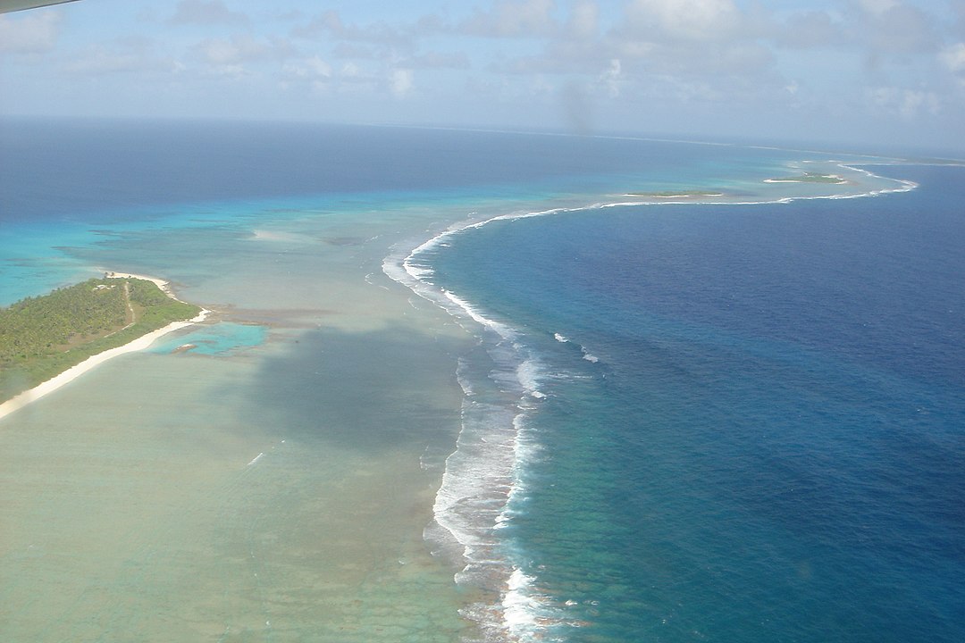
Bikini Atoll in the Marshall Islands bears the legacy of nuclear testing from 1946 to 1958, a reef ringed by shipwrecks and residual hotspots. Wildlife returned, but some soils and lagoons still carry contaminants, and resettlement remains limited. Permits control access, and divers treat the site as both graveyard and archive. The water is clear and alluring, yet the history lingers in Geiger counts and caution signs, proof that experiments can outlast their authors.