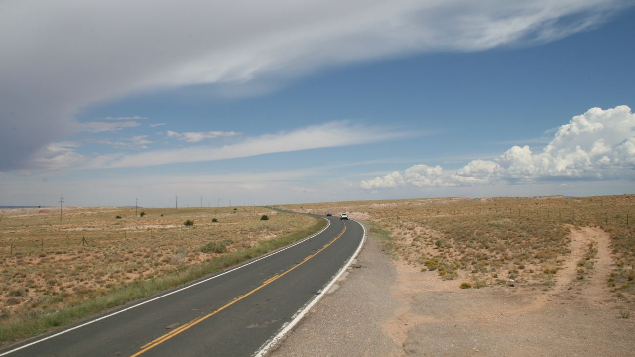
Big-name highways get jammed. These lesser-known routes keep the views, not the traffic. You will cross quiet deserts, lava-colored canyons, deep forests, and river gorges without tour-bus lines. Each pick includes concrete details like miles, elevations, or park dates to help planning. Bring paper maps where service drops, and fuel up early in small towns. Respect posted limits and wildlife crossings. With smart timing and a cooler in back, you can trade brake lights for long horizons and empty pullouts.
1. US 50, Fallon to Austin, Nevada
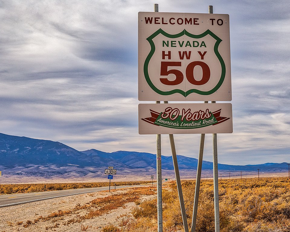
This lonely 110-mile stretch of US 50 skips the I-80 rush and threads Basin and Range valleys. You’ll pass Pony Express station sites from 1860–1861 and tiny stops like Middlegate. Speed limits hit 70 mph, yet traffic stays thin between Fallon’s farms and Austin’s 1862 mining streets. Summer heat tops 90°F, so carry water. Services are sparse after Cold Springs. At sunset the Toiyabe Range glows red, and you may drive 10 minutes without seeing headlights, even in July weekends.
2. US 191 Coronado Trail, Arizona
Between Clifton and Alpine, US 191 climbs from copper pits near 3,500 feet to forests above 8,000. Locals still call it the Coronado Trail, once signed US 666. Expect hundreds of curves over roughly 120 miles and long gaps with no fuel. Elk step out at dusk near 8,000 feet, and winter closes sections after storms. Traffic is light compared with US 60. Morenci’s open-pit mine dates to the 1880s, and the high stretch near Alpine feels like a private balcony above the White Mountains.
3. CO-149 Silver Thread, Colorado
Colorado 149 runs about 117 miles from South Fork to Blue Mesa Reservoir, passing Creede and Lake City. Slumgullion Pass tops 11,530 feet, and the North Clear Creek Falls overlook sits just off the road. The byway earned state scenic status in 1988, yet July volume stays modest outside holiday weeks. Watch for mule deer at dawn and thin air above 10,000 feet. Fuel in towns; stretches between can run 40 miles. Old mining facades, big sky, and little traffic beat crowded US 550.
4. Journey Through Time, Oregon
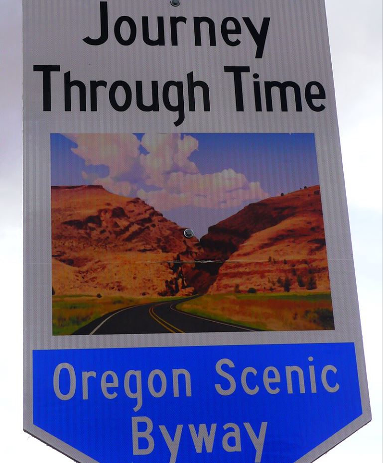
Follow US 26 and OR 19 through the John Day country, where John Day Fossil Beds National Monument (created 1975) preserves about 14,000 acres. Painted Hills near Mitchell glows at late light, and the Sheep Rock Unit shows layered ash from millions of years. Distances are real: Mitchell to Dayville is about 45 miles with few services. Summer highs often top 90°F, so carry extra water. Compared with US 101’s crowds, these two-lanes feel open, with ranch gates, basalt cliffs, and empty trailheads.
5. Salmon River Byway, Idaho
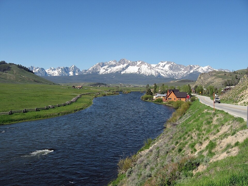
Link Stanley to Salmon via ID 75 and US 93, about 130 miles along the Salmon River. The Sawtooth National Recreation Area began in 1972 and guards jagged peaks above 10,000 feet. Stanley sits near 6,200 feet and sees frosty mornings even in August. Stop at Sunbeam Hot Springs and the 1940s Yankee Fork dredge site. Traffic is light outside salmon runs. Watch for bighorn signs in narrow canyons, and expect service gaps between Challis and Ellis. Paper maps help when bars vanish.
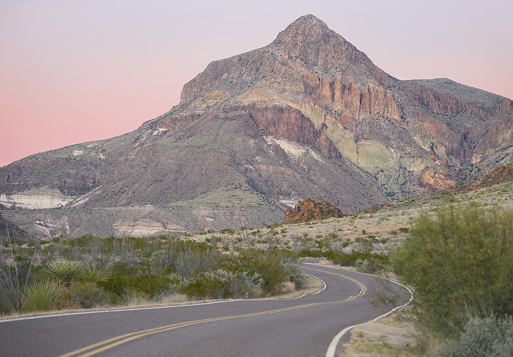
6. FM 170 River Road, Texas
From Lajitas to Presidio, FM 170 hugs the Rio Grande for roughly 50 miles with blind curves and tight grades. Big Bend Ranch State Park, established 1994, covers over 300,000 acres of desert mesas. Expect almost no shade and limited cell service. Carry extra water per person, at least 1 gallon for summer days. Border scenery is huge, yet you may trail only one pickup for an hour. Compared with Big Bend National Park’s busier routes, this ribbon feels like your own movie set.
7. MN-38 Edge of the Wilderness, Minnesota
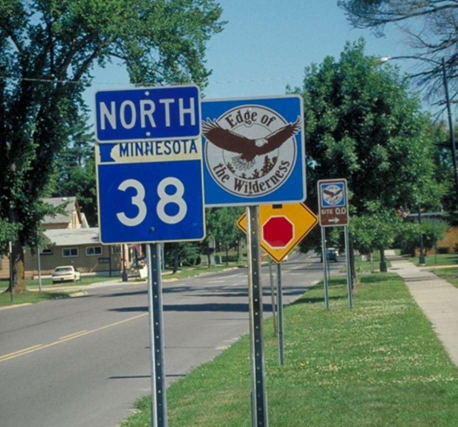
Minnesota 38 runs 47 miles from Grand Rapids to Effie, a 1992 National Scenic Byway through Itasca County’s lake maze. The county claims over 1,000 lakes, and this road touches many boat ramps and camp spurs. Speeds drop to 45 mph through curves, which keeps it quiet. Summer loons call at dusk, and fall color peaks late September. Gas is limited between Marcell and Bigfork, so top off. Compared with busy MN-61 on Lake Superior, you’ll meet more pines than cars.
8. Big Bend Scenic Byway, Florida
Skip Orlando traffic and loop the Florida Big Bend on US 98 and FL 30 between Apalachicola and St. Marks. The byway network tops 200 miles and edges Apalachicola National Forest, established 1936 with more than 600,000 acres. Towns stay low-rise, and oyster shacks close early. Watch for black bear crossing signs near forest miles. Summer storms arrive fast, so check radar and avoid flooded shoulders. Compared with US 1 in the Keys, this coast feels empty, wild, and wonderfully slow.
9. US 6, Pennsylvania Wilds
Follow US 6 across northern Pennsylvania from Wellsboro toward Warren, and you’ll skirt Pine Creek Gorge, often called the state’s Grand Canyon. Leonard Harrison State Park dates to 1924 and posts overlooks above 1,000 feet deep walls. Distances between towns run 20–40 miles, so plan rest stops. Traffic remains light outside October foliage. Expect 45–55 mph limits and elk signs near Benezette farther west. Compared with I-80, US 6 trades trucks for barns, iron bridges, and quiet two-lane rhythm.
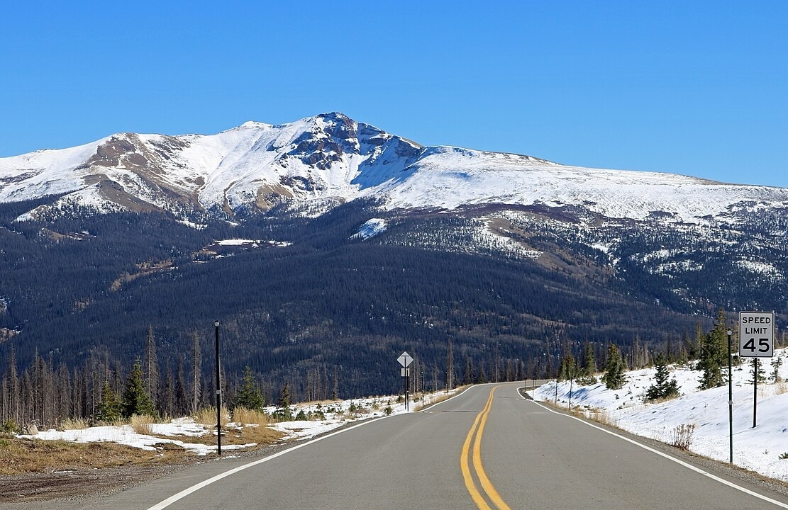
10. Wind River Canyon, Wyoming
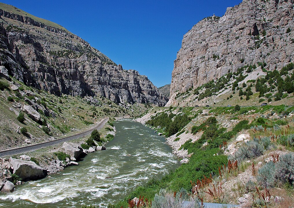
US 20/WY 789 slices 34 miles from Shoshoni to Thermopolis through Wind River Canyon tunnels cut in the 1920s. Road cuts reveal rocks up to billions of years old, labeled at pullouts. Thermopolis hosts Hot Springs State Park, set aside in 1897, with a 104°F bath house. The canyon often runs at 65 mph, yet you’ll find wide shoulders for photos. Bighorn River rafters drift below, and traffic is light compared with Yellowstone approaches. Watch for gusts blasting from tunnel mouths.