Iconic drives like the Pacific Coast Highway and Blue Ridge Parkway are gorgeous, but that is exactly why they are packed most of the year. If you want the same wow factor without the brake-light parade, point your wheels toward these less obvious routes. Each one pairs big scenery with calmer traffic, good pullouts for photos, and enough services for a stress-free day. We focused on officially designated scenic byways or state-promoted corridors, so you get reliable maps, seasonal guidance, and safe turnouts rather than sketchy back roads.
How we chose
To keep things truly crowd-beating, every pick had to deliver three things: a scenic payoff that rivals famous routes, lighter congestion for most of the season, and simple planning for first-time road trippers. We favored places with clear mile-by-mile info from park, forest, or tourism offices, and we note any seasonal quirks so you can time it right.
The routes
These ten drives favor scenery over crowds. Most routes are paved with signed pullouts; gravel spurs are optional. Plan 2 to 6 hours of driving, check seasonal closures, fuel early, download offline maps, and watch for wildlife at dawn and dusk.
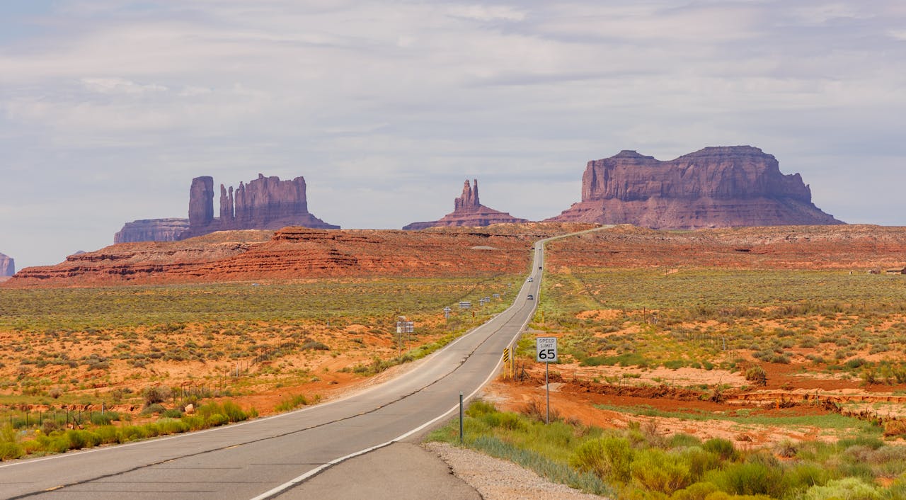
1) Davis Mountains Scenic Loop, Texas
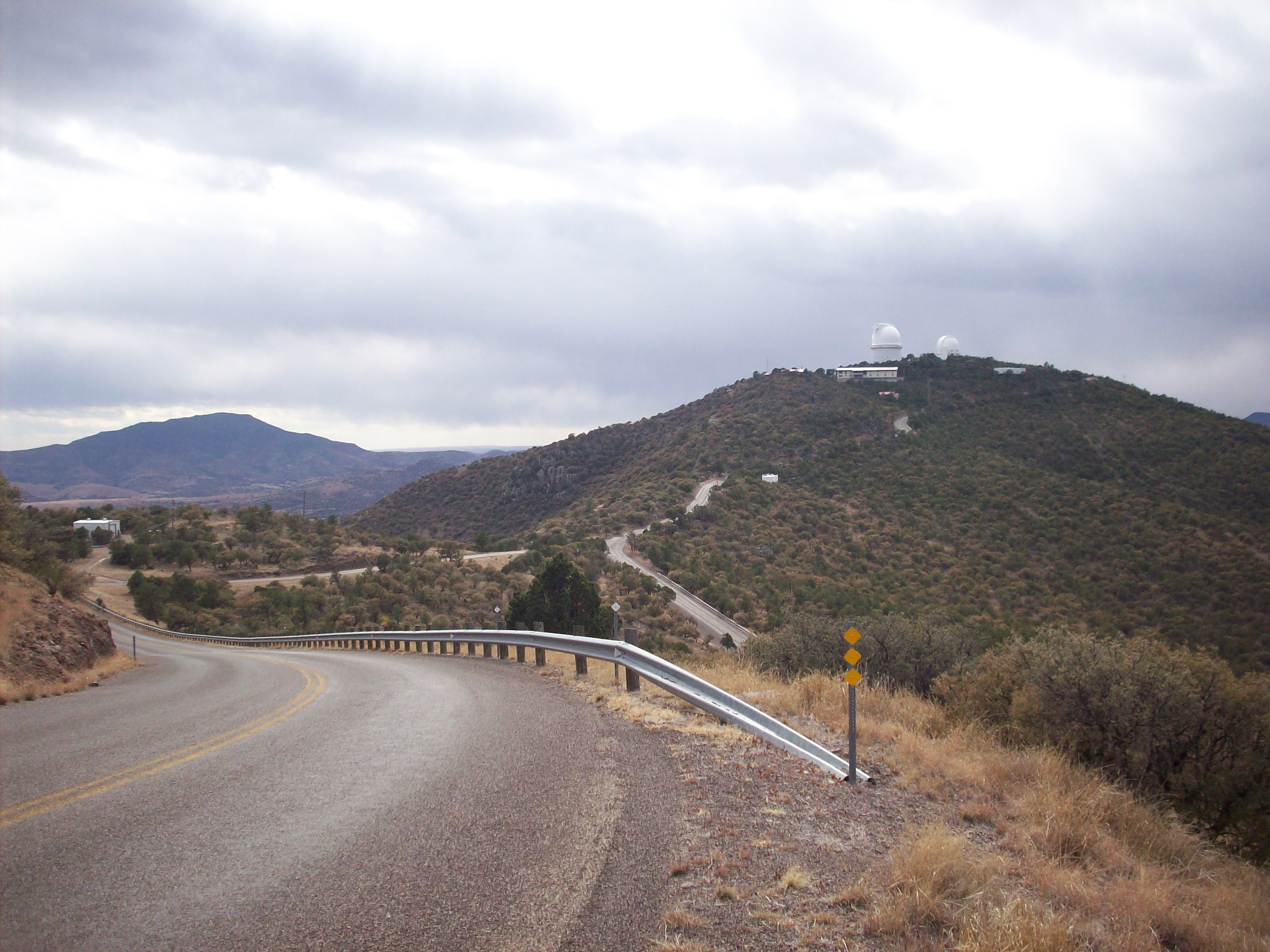
A 75-mile figure-eight on TX 166 and TX 118 wraps volcanic peaks, high-desert grasslands, and star-dark skies around Fort Davis. It is one of Texas’s loftiest paved drives, with long-view pullouts and almost no stoplights. Plan a late-afternoon circuit, then head up to McDonald Observatory for a stargazing program on select nights. Light traffic, big space, and true sky island vibes make this feel nothing like the interstate.
2) River Road FM 170, Big Bend Ranch State Park, Texas
Locals call it Camino del Rio, a twisting ribbon that tracks the Rio Grande between Lajitas and Presidio. Expect sweepers, hoodoos, and roadside river access with almost no development in sight. Pull over at signed waysides for short hikes or put-ins if you have paddling plans. Note the undulating pavement and limited shoulders, and avoid taking large RVs into the tightest sections. Clear maps and park guidance make planning straightforward.
3) Hells Canyon Scenic Byway, Oregon
This 213-mile loop circles the Wallowa Mountains and overlooks North America’s deepest river gorge. You will roll past farm towns, trailheads, and viewpoints that stay quiet even in peak season. Start in La Grande or Baker City and follow the well-signed loop to Joseph and back. The byway’s site offers turn-by-turns and seasonal tips, so you can dodge snow at the highest passes and still claim empty overlooks.
4) Payette River Scenic Byway, Idaho
Highway 55 climbs from Boise to New Meadows beside blue water, pine, and canyon walls. It is the definition of accessible wild, with towns like Cascade and McCall for fuel and food. For an even quieter spur, loop the Wildlife Canyon Byway along the Banks-Lowman Road, where the South Fork Payette roars below the pavement. Weekdays and shoulder seasons feel especially uncrowded compared with bigger name Western drives.
5) Jemez Mountain Trail National Scenic Byway, New Mexico
This 66-mile circuit threads red cliffs, hot springs, and ponderosa forest, connecting the Valles Caldera’s volcanic story with historic pueblos and tiny towns. It is a concentrated sampler of New Mexico’s geology without Santa Fe or Taos traffic. Begin near San Ysidro, climb NM-4 through Jemez Springs, then loop back on US-550. State and national byway pages outline highlights and make it easy to plan stops.
6) Utah’s Patchwork Parkway, Scenic Byway 143
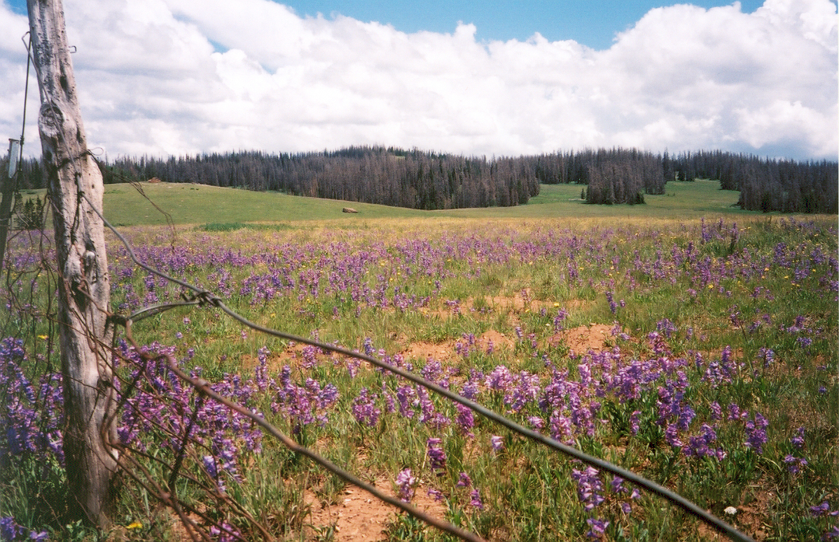
From Parowan, this high-alpine route climbs 4,400 feet in under 10 miles, then glides past Brian Head, Cedar Breaks, and Panguitch Lake. It is a crisp, colorful alternative when Zion and Bryce lots are overflowing. Expect meadows, lava flows, and hoodoo vistas with cooler temps than the desert floor. Give yourself time for Cedar Breaks overlooks and a picnic under the spruce.
7) Loess Hills National Scenic Byway, Iowa
Wave-shaped bluffs formed by ancient wind-blown silt rise along the Missouri River, creating a one-of-a-kind landscape you can cruise in peace. The paved mainline runs roughly 220 miles with optional gravel loops for wildlife viewing. Stop at overlooks and preserves to spot prairie blooms and migrating raptors. The byway’s guide maps out services and side trips, so you can tailor an easy weekend.
8) Flint Hills National Scenic Byway, Kansas
Tallgrass prairie once covered the heart of North America. You can still feel that vastness on KS-177 between Council Grove and Cassoday. Rolling hills, limestone fences, bison at Tallgrass Prairie National Preserve, and big sky define the drive. Traffic is light compared with major parkways, and the route is short enough to pair with a hike or ranch-town lunch. Official maps and turnouts make navigation simple.
9) Highland Scenic Highway, West Virginia
WV-150 was built for views. This ridge-top road crosses the Allegheny Highlands above 4,500 feet with four signed overlooks and minimal development. It is closed to plowing in winter, so late spring through early fall is the sweet spot. Expect spruce, bog boardwalks, and endless layers of blue ridges without the gridlock you see near national park gateways.
10) Edisto Island National Scenic Byway, South Carolina
When Myrtle Beach is bumper-to-bumper, steer for the Lowcountry’s tree-tunneled SC-174. This 17-mile byway ambles past marsh, live oaks, and small farms to Edisto Beach, with room to breathe at pullouts and boardwalks. It is a rare coastal drive that still feels unhurried, and the official byway resources list 30 points of interest so you can build a relaxed day trip.
Planning tips to stay stress-free
Check seasonal notes before you go. High roads in West Virginia and Utah can close due to snow or storms, and river canyons in Idaho or Texas run hot in midsummer. Official forest, park, or byway pages post current advisories and parking guidance, which helps you dodge closures and construction.
Build a loose schedule. Under-the-radar does not mean service-rich at every mile. Top off the tank when you can, download offline maps, and carry water. Quiet routes stay quiet partly because they cross public land and open range, not a string of chain stores.
Match the pace to the place. These corridors were designed for overlooks, short walks, and slower speeds. Use pullouts for photos; never blind corners. Respect private ranch gates and Leave No Trace at trailheads.
Sources
- Davis Mountains Scenic Loop overview and mileage; McDonald Observatory visitor info. Texas Highways+2Texas Time Travel+2
- Big Bend Ranch State Park guidance for River Road FM 170 and scenic drive notes. tpwd.texas.gov+1
- Hells Canyon Scenic Byway route details and loop description. hellscanyonbyway.com+1
- Payette River National Scenic Byway and Wildlife Canyon Byway descriptions. Payette River Scenic Byway+2Visit Idaho+2
- Jemez Mountain Trail National Scenic Byway descriptions and highlights. New Mexico+1
- Utah SR-143 Patchwork Parkway route and sights, plus Cedar Breaks scenic drive context. National Scenic Byway Foundation+1
- Loess Hills National Scenic Byway route and planning resources. Loess Hills National Scenic Byway+1
- Flint Hills National Scenic Byway mapping and state overview. fhwaapps.fhwa.dot.gov+1
- Highland Scenic Highway official U.S. Forest Service page and WV-150 winter note. US Forest Service+1
- Edisto Island National Scenic Byway route length and points of interest. discoversouthcarolina.com+2National Scenic Byway Foundation+2