
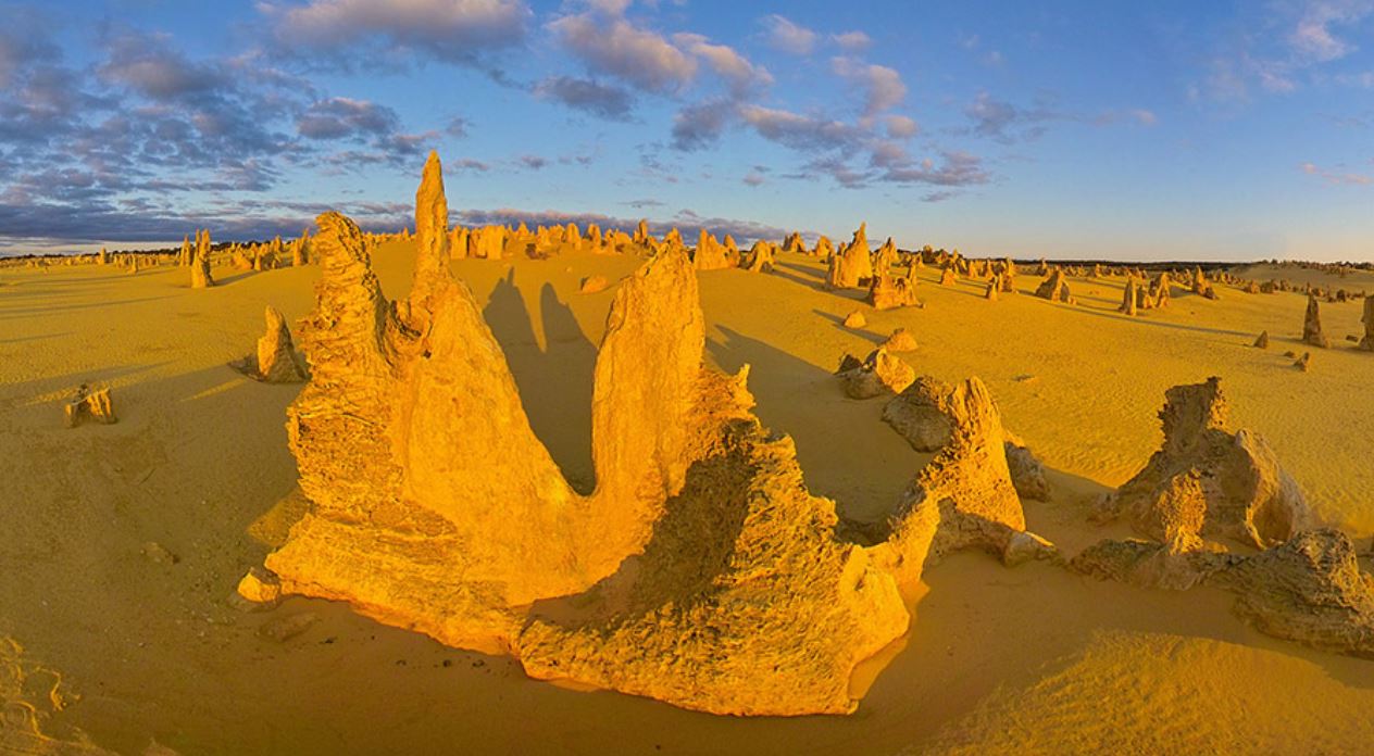
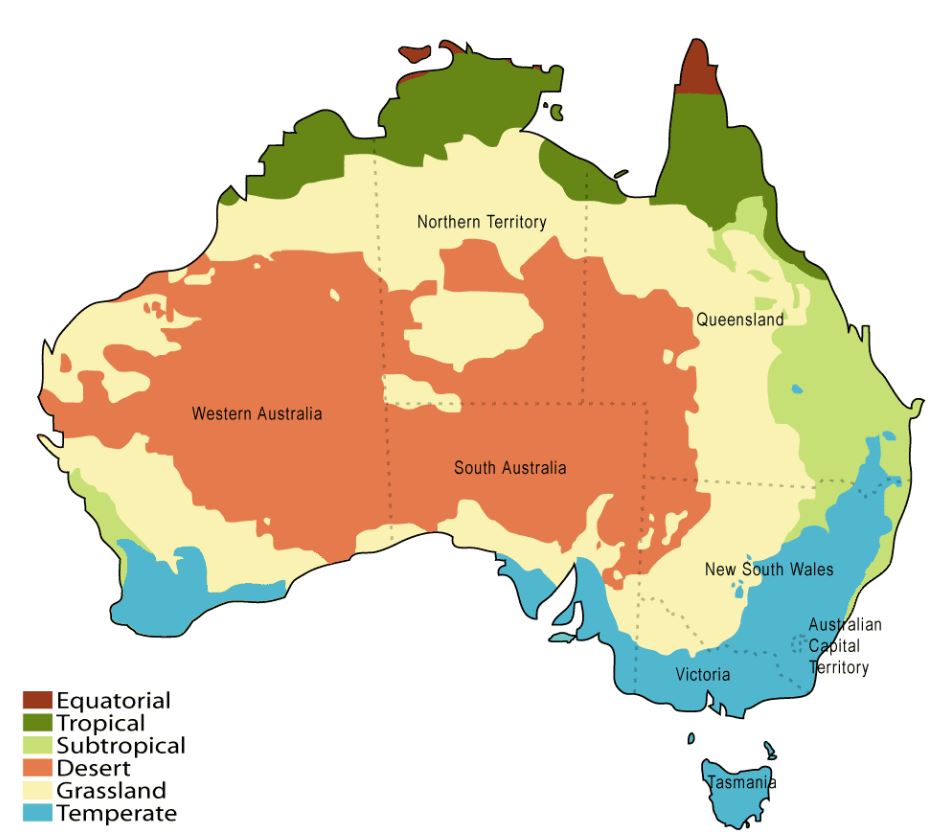
Scientists finally decoded the strange landscape people call the Ancient Iron Desert. It sits in Western Australia at Nambung National Park, where thousands of yellow limestone towers rise from deep sand. For decades, geologists have argued about how and when this maze formed. A new study used tiny iron-rich nodules as natural clocks and pinned the story down. The result points to a dramatic wet phase about one hundred thousand years ago that sculpted the pillars we see today.
What The Desert Really Is
The desert is famous as the Pinnacles, a field of limestone spires two hours north of Perth. The rock started as wind blown sand that later turned to limestone. Over time, chemical weather dissolved much of that stone and left hardened columns standing. While the pillars look metal from far away, the iron shows up mainly as thin coatings and pebble sized nodules on the surfaces. Those nodules became the key to telling time and unlocking the age of the landscape.
How Scientists Dated It
Researchers sampled the small iron rich nodules that cling to the sides of the spires. Most are made of the mineral goethite. Tiny amounts of uranium and thorium inside these grains release helium as they decay. By measuring the helium locked in each nodule with a method called U Th He dating, the team calculated when the nodules formed. Results cluster near one hundred and three thousand years ago, matching a known wet interval called marine isotope stage five c.
What Created The Pillars
The dates point to a brief but intense wet spell when rain soaked the coast. Acidic water percolated through the dunes and carved the limestone like Swiss cheese. Hollows merged, and the weakest rock vanished, while sturdier patches resisted and survived as towers. As the landscape dried, winds piled sand around the bases, hiding and revealing spires through the seasons. The iron nodules formed during that wet phase, so their ages mark the moment the Pinnacles took shape.
Why Experts Trust The Result
The team cross-checked the timeline against other clocks in the area. Layers of sand above and below had been dated earlier with luminescence methods, and carbonate cements carry their own age signals. The iron clock fits neatly between those bounds, which boosts confidence. Multiple labs have repeated the measurements and found the same cluster of ages. That tight agreement is why researchers say the mystery is finally solved rather than just shifted to a new argument.
Why It Matters Beyond Australia
This is more than a local story. Coastal belts of wind-blown limestone circle much of the world, from the Mediterranean and Caribbean to parts of Africa and the Middle East. If those areas also hold iron rich nodules, the same method can reveal when extreme wet periods hit and how fast landscapes changed. Linking many sites would sharpen climate timelines and test models that predict future coastal change as storms and sea levels shift. For students, it shows how a clever measurement on tiny grains can rewrite a giant chapter of Earth history.
What Comes Next
Open questions remain. Scientists still want to know why some columns survived while nearby blocks vanished. Subtle differences in cement, early root channels, or slight shifts in groundwater might have protected certain patches. Future work will map chemistry along single towers and compare shapes to rainfall patterns. As data accumulates, we will learn whether chance or structure chose the survivors, adding new detail to the story that this study unlocked.