Ready to test your map skills and your comfort zone. These trips reach the world’s high peaks, deep basins, and far frontiers. You will see hard numbers, like 17,598 feet at Base Camp or 282 feet below sea level in Death Valley. You will also learn seasons, rules, and safety basics that make these places work. Pack layers, water, and patience. Respect local permits and posted signs. Extreme spots reward careful planning, not shortcuts, so travel smart and leave no trace.
1. Everest Base Camp, Nepal’s High-Altitude Trek
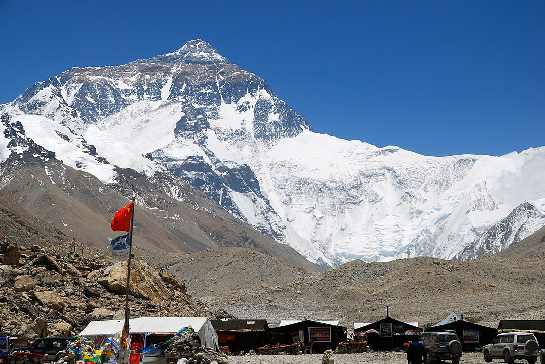
Everest Base Camp sits about 17,598 feet, or 5,364 meters, inside Sagarmatha National Park, created in 1976 and listed by UNESCO in 1979. The classic round trip is about 80 miles, with popular seasons in April to May and October to November. You will feel thin air above 10,000 feet, so plan rest days to prevent altitude sickness. Permits are required, and flights to Lukla often change with weather. Stay on signed trails, treat water, and never push pace if you feel dizzy or short of breath.
2. Dead Sea Float, Earth’s Lowest Shoreline
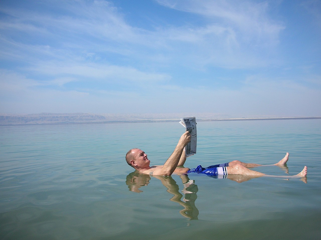
The Dead Sea’s shoreline lies around 1,410 feet below sea level, the lowest exposed land on Earth. Water here is roughly 34 percent salt, so you float without effort, but do not dive or put your face in. Beaches on the Jordan and Israel shores post rules, including rinsing stations and lifeguard hours. Limit time in the water, then shower to protect skin and eyes. Summer highs regularly pass 100°F, so bring water and a hat, and wear sandals on hot, crusted rock.
3. Badwater Basin, Death Valley’s Salt Flats
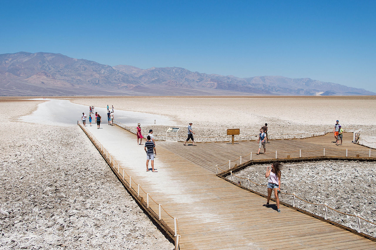
Badwater Basin in California sits 282 feet below sea level, a broad salt pan with hexagon patterns underfoot. Death Valley recorded a 134°F air temperature at Furnace Creek in 1913, one of the highest on record. Summer hiking is risky, so visit early or in winter. Stay near the boardwalk if heat rises fast, and carry at least 1 gallon of water per person. Rangers post closures when flooding softens the crust. Keep children on the packed path, and never drive onto the fragile flats.
4. South Pole Access, Antarctica’s 90°S Goal
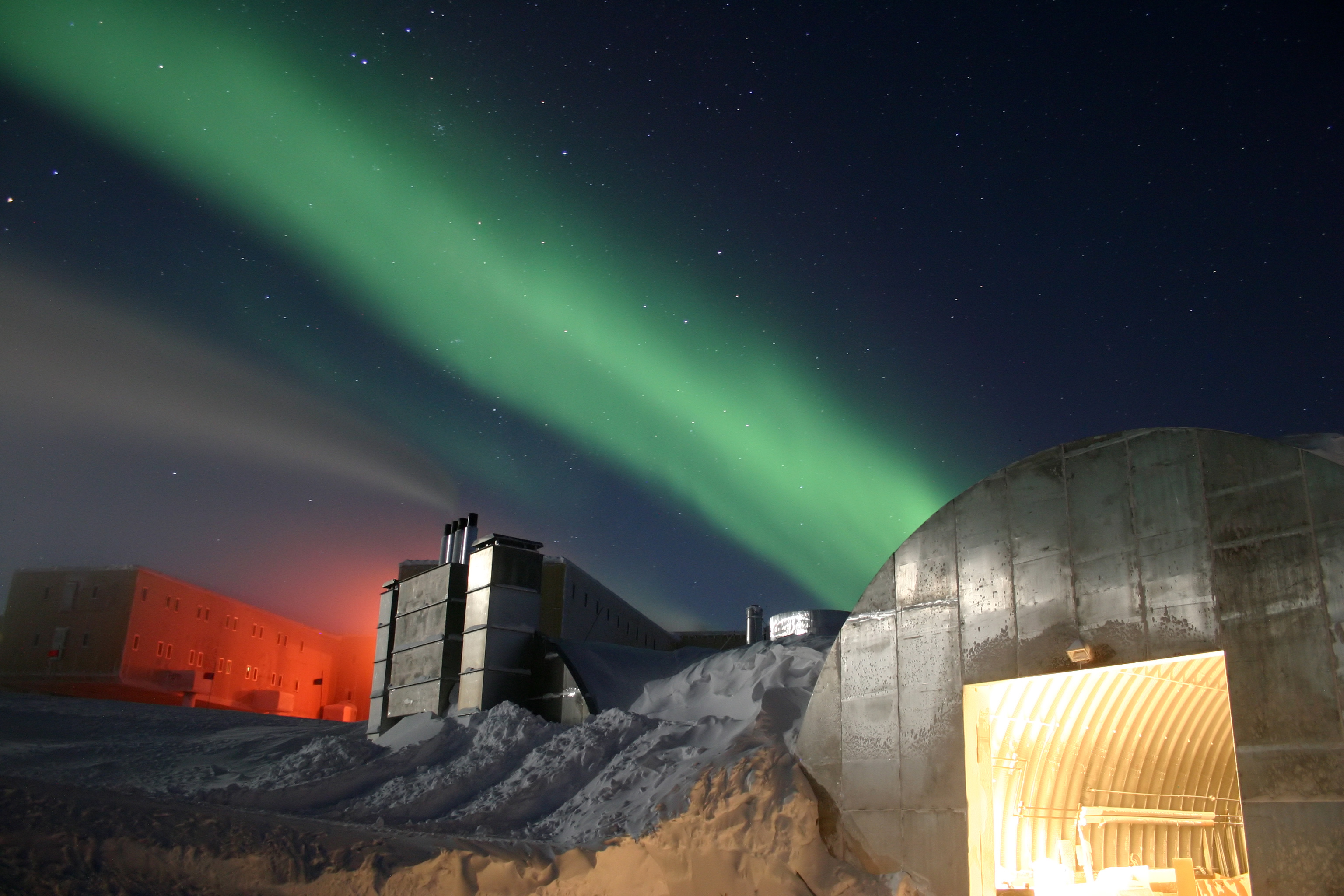
The geographic South Pole sits at 90°S with the Amundsen–Scott Station operating since 1956. Summer access runs roughly November to January by ski or small aircraft, with temperatures often below −20°F even in daylight. Elevation near 9,300 feet, plus dry cold, makes breathing hard. Visitors follow Antarctic Treaty rules and IAATO guidelines, which protect wildlife and research sites. Stay on flagged routes, keep food sealed, and watch for frostbite on cheeks and fingers. Trips require insurance, gear checks, and strict waste carry-out.
5. Tristan da Cunha, Most Remote Inhabited Island
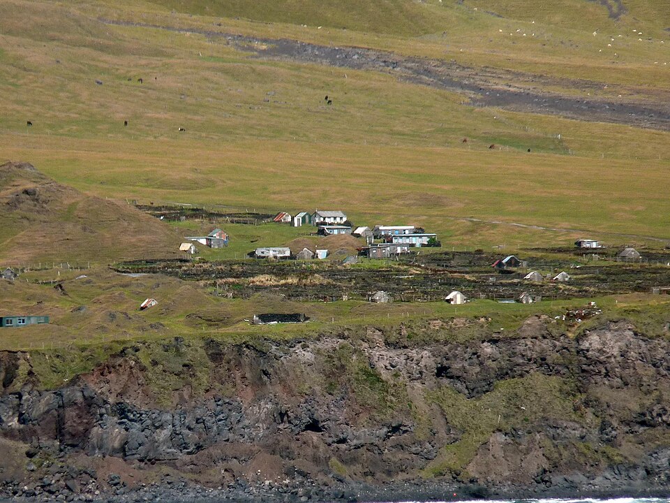
Tristan da Cunha in the South Atlantic is often called the most remote inhabited island, about 2,800 kilometers from Cape Town. Fewer than 300 people live in Edinburgh of the Seven Seas. There is no airport, so passenger ships take about 6 days each way, and landing depends on weather. Visits require permission and a flexible schedule. Pack seasickness meds and cash, since banking is limited. Biosecurity is strict, clean boots and no fresh produce without approval. Respect closed areas for seabirds and fragile crops.
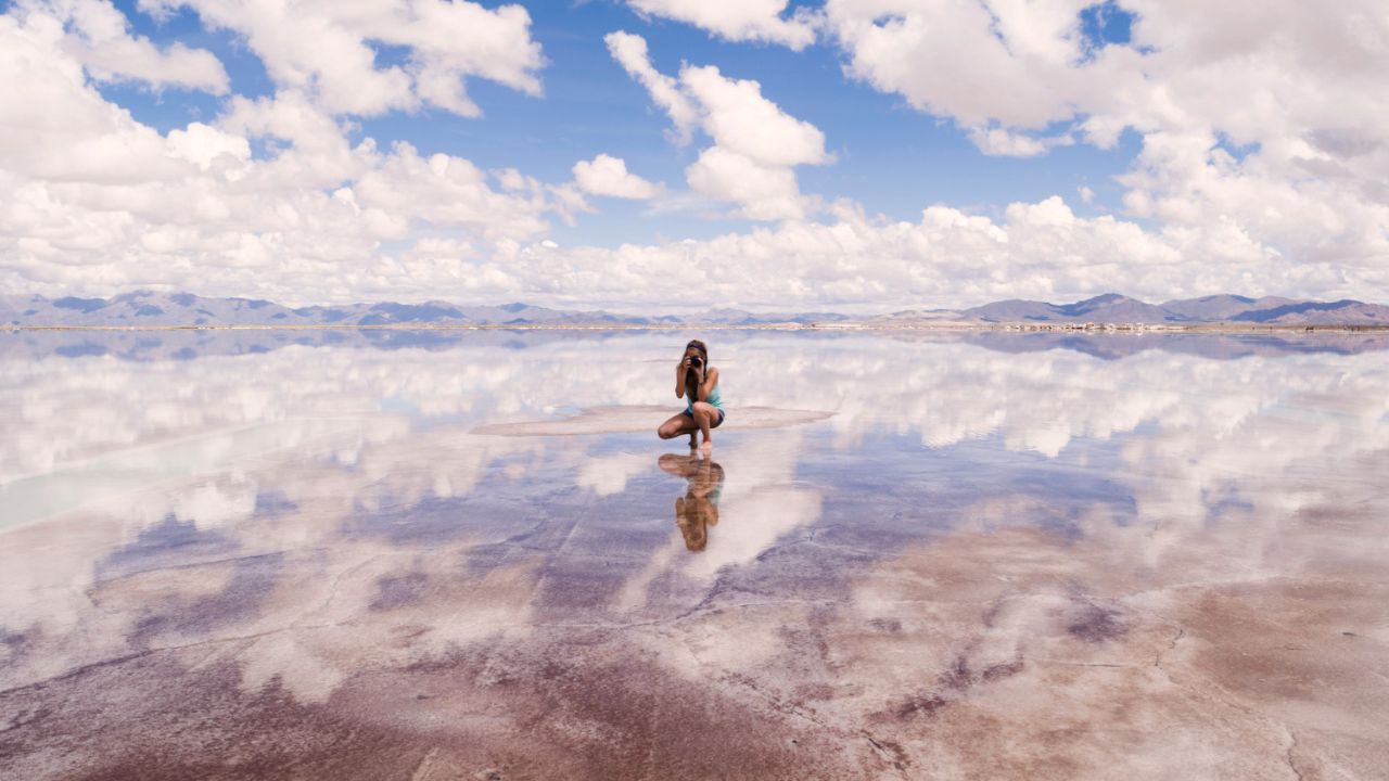
6. Salar de Uyuni, Bolivia’s Giant High Plateau
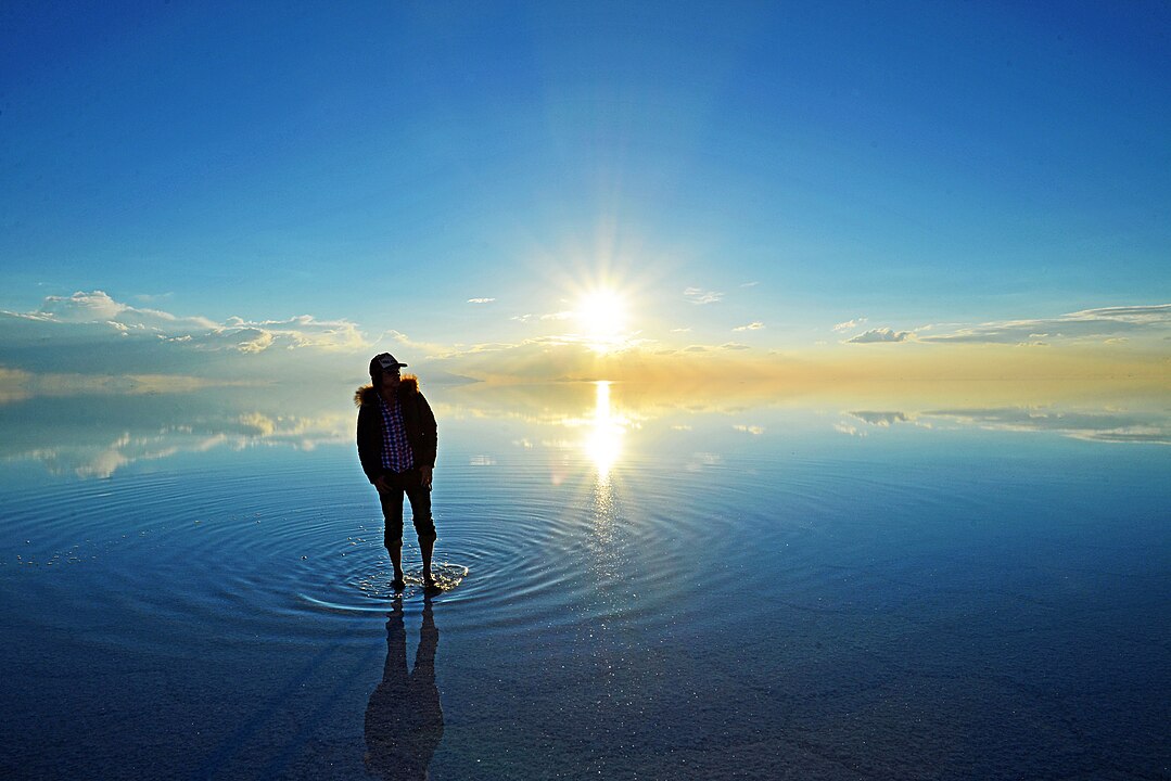
Salar de Uyuni spans about 10,582 square kilometers at roughly 11,975 feet above sea level. In the rainy season, often November to March, a thin layer of water turns the flats into a mirror. Dry months allow 4×4 travel to Isla Incahuasi and old rail beds near Uyuni, a town tied to 1890s mining. Nights can drop below freezing even in October, so pack a warm jacket. Drive with licensed guides, avoid off-route tracks that damage crust, and keep sunglasses ready for blinding glare.
7. Svalbard, Norway’s High Arctic Gateway
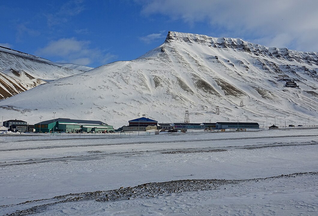
Longyearbyen sits near 78°N, with midnight sun from about late April to late August and polar night in winter. Temperatures in January often hover near 14°F, and wind makes it feel colder. Outside town, local rules require a guide or suitable protection because polar bears roam year round. Tours post safety briefings, including flare gun use and group spacing on sea ice. The Governor’s office enforces travel plans for certain routes. Dress in layers, carry a thermos, and keep batteries warm to protect cameras.