Stormy skies rarely explode out of nowhere. Before wind roars and rain turns sideways, the atmosphere usually sends clear visual warnings. Certain clouds appear only when air is surging, twisting, and collapsing with real force. For storm spotters, pilots, and anyone who spends time outside, these shapes become a quiet language of risk. Learning what they mean does not remove the danger, but it does shift things slightly toward preparation, calm decisions, and getting to solid shelter in time.
Towering Cumulonimbus With Dark Bases

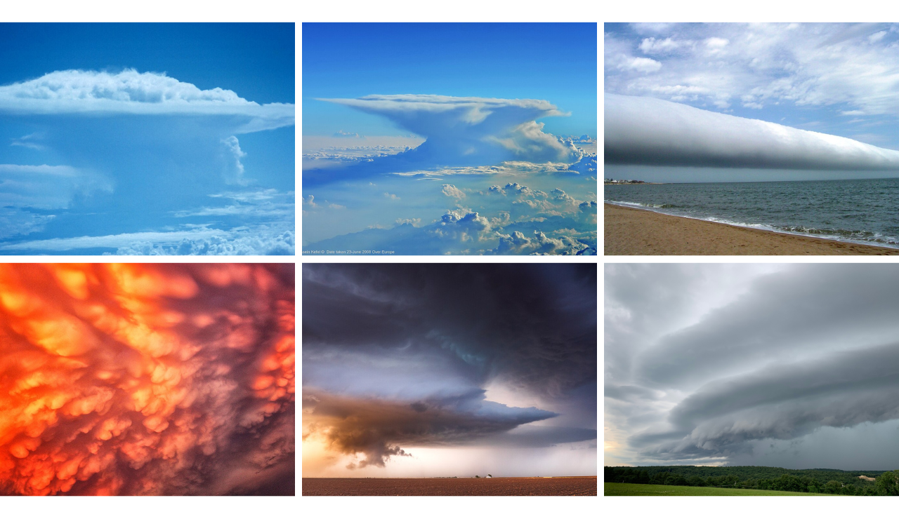
Towering cumulonimbus clouds with dark, sagging bases are classic trouble. Their cauliflower tops balloon upward as warm, moist air races skyward, feeding taller and taller columns. Near the ground, the base thickens, turns charcoal, and often hides sheets of falling rain or hail. When the air grows heavy and flashes of lightning start leaping inside the cloud instead of far away, conditions around nearby farms, highways, and neighborhoods can shift from quiet to violent in only a few minutes.
Anvil-Shaped Thunderstorm Tops

Anvil-shaped tops spread out high in the sky when a storm grows strong enough to slam into a stable layer of air and flatten. That icy shield can stretch for many miles downwind, forming a broad, hazy ceiling. When the anvil edge drifts overhead, and the world seems oddly dim and still, the core of the storm often sits close. Large hail, frequent lightning, and pounding rain commonly lurk under or just ahead of that pale, looming edge.
Rotating Wall Clouds Beneath The Base

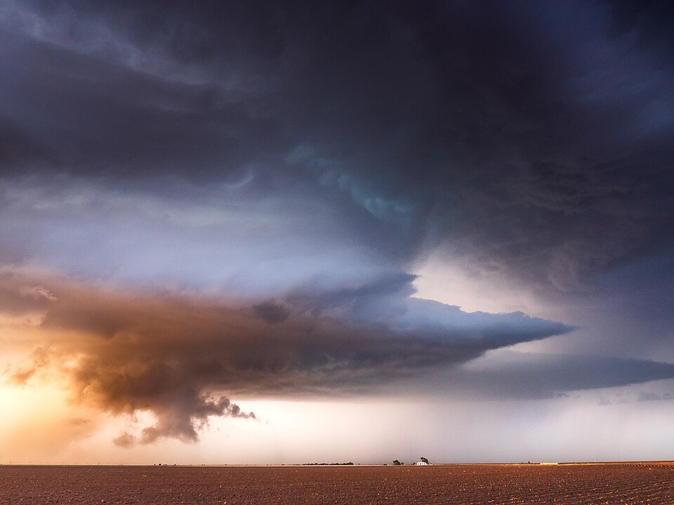
A rotating wall cloud that hangs beneath a thunderstorm base ranks among the most serious visual warnings. The lowered section often looks like a rounded collar or block attached to the underside of the main cloud deck. It may pull in smaller fragments, tighten its spin, and slowly sink. When rotation becomes smooth and focused, tornado potential rises quickly. Nearby fields, parking lots, and neighborhoods can move from heavy rain to life-threatening wind and flying debris in moments.
Low Racing Shelf Clouds On The Front

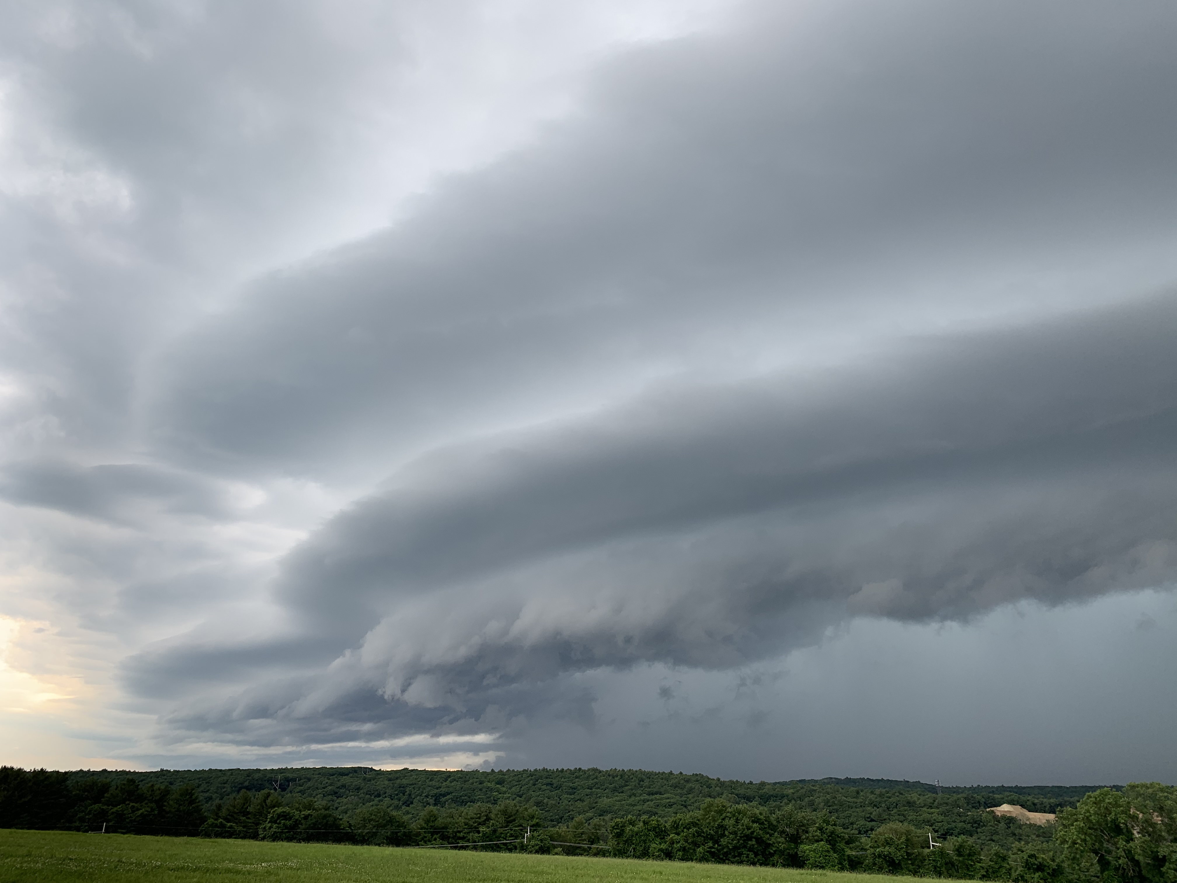
Low racing shelf clouds along the leading edge of a storm resemble a dark, sculpted ledge sweeping across the horizon. They mark the boundary where cool outflow from the storm plows into warm surface air and forces it aloft in a hurry. As that boundary passes overhead, gusts often slam through trees, topple unsecured items, and whip dust or spray across roads. Right behind the shelf, blinding rain and frequent lightning usually arrive, shrinking visibility and spiking local danger.
Rolling Tubes Along The Gust Front

Roll clouds appear as long, detached tubes that seem to slowly rotate along their length, riding ahead of a storm on the gust front. They form where cool outflow air slides under warmer air and starts rolling, like a sideways breaker wave. The roll itself seldom produces tornadoes, yet its presence often lines up with a sharp wind surge, a quick temperature drop, and swirling leaves or dust. For nearby towns and lakes, the first hard hit is close.
Mammatus Pouches Under The Anvil

Mammatus clouds hang from the underside of a storm anvil like rows of rounded pouches, giving the sky a strange, lumpy texture. They appear when pockets of cooled air sink into the air beneath the anvil and drag moisture with them. While mammatus clouds do not cause damage on their own, they often follow or flank mature severe storms that have already unleashed intense updrafts. Their presence tells nearby communities that the atmosphere has been pushed to a volatile extreme.


